Machin, Ontario
Machin | |
|---|---|
Township (single-tier) | |
| Township of Machin | |
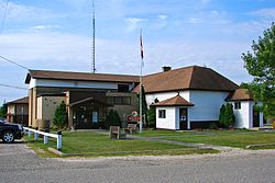 Township office in Vermilion Bay | |
 Machin | |
| Coordinates: 49°47′N 93°10′W / 49.783°N 93.167°WCoordinates: 49°47′N 93°10′W / 49.783°N 93.167°W | |
| Country | Canada |
| Province | Ontario |
| District | Kenora |
| Government | |
| • Mayor | Gordon Griffiths |
| • Federal riding | Kenora |
| • Prov. riding | Kenora—Rainy River |
| Area | |
| • Land | 291.81 km2 (112.67 sq mi) |
| Population (2016)[2] | |
| • Total | 971 |
| • Density | 3.3/km2 (9/sq mi) |
| Time zone | UTC-6 (CST) |
| • Summer (DST) | UTC-5 (CDT) |
| Postal Code FSA | P0V |
| Area code(s) | 807 |
| Website | www.visitmachin.com |

Machin is a township in the Canadian province of Ontario, located in the Kenora District west of Dryden.
The main communities in Machin township are Eagle River, Minnitaki, and Vermilion Bay. The junction of Highway 17 and Highway 105 is located in Machin, just east of Vermilion Bay.

Minnitaki, Ontario

Vermilion Bay, Ontario


Demographics[]
| Canada census – Machin, Ontario community profile | |||
|---|---|---|---|
| 2016 | 2011 | 2006 | |
| Population: | 971 (+3.9% from 2011) | 935 (-4.4% from 2006) | 978 (-14.4% from 2001) |
| Land area: | 291.81 km2 (112.67 sq mi) | 289.84 km2 (111.91 sq mi) | 288.85 km2 (111.53 sq mi) |
| Population density: | 3.3/km2 (8.5/sq mi) | 3.2/km2 (8.3/sq mi) | 3.4/km2 (8.8/sq mi) |
| Median age: | 50.6 (M: 50.1, F: 50.9) | 47.0 (M: 48.5, F: 46.0) | 43.3 (M: 43.3, F: 43.3) |
| Total private dwellings: | 597 | 560 | 481 |
| Median household income: | $70,464 | $55,616 | |
| References: 2016[3] 2011[1] 2006[4] earlier[5] | |||
Historic populations:[2][1][6]
- Population in 2016: 971
- Population in 2011: 935
- Population in 2006: 978
- Population in 2001: 1,143
- Population in 1996: 1,117
- Population in 1991: 1,127
See also[]
References[]
- ^ a b c "2011 Community Profiles". 2011 Canadian Census. Statistics Canada. July 5, 2013. Retrieved 2012-04-03.
- ^ a b "Census Profile, 2016 Census: Machin, Municipality". Statistics Canada. Retrieved June 6, 2019.
- ^ "2016 Community Profiles". 2016 Canadian Census. Statistics Canada. February 21, 2017. Retrieved 2019-06-06.
- ^ "2006 Community Profiles". 2006 Canadian Census. Statistics Canada. March 30, 2011. Retrieved 2011-06-28.
- ^ "2001 Community Profiles". 2001 Canadian Census. Statistics Canada. February 17, 2012.
- ^ Statistics Canada: Canada 1996 Census
External links[]
Places adjacent to Machin, Ontario | |
|---|---|

This Northern Ontario geographical article is a stub. You can help Wikipedia by . |
Categories:
- Municipalities in Kenora District
- Single-tier municipalities in Ontario
- Township municipalities in Ontario
- Northern Ontario geography stubs