Mad Wolf Mountain
| Mad Wolf Mountain | |
|---|---|
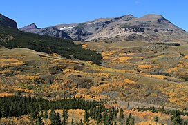 East aspect from Highway 49 | |
| Highest point | |
| Elevation | 8,341 ft (2,542 m)[1] |
| Prominence | 456 ft (139 m)[1] |
| Parent peak | Red Mountain[1] |
| Coordinates | 48°34′04″N 113°22′07″W / 48.56778°N 113.36861°WCoordinates: 48°34′04″N 113°22′07″W / 48.56778°N 113.36861°W[2] |
| Geography | |
 Mad Wolf Mountain Location in Montana | |
| Location | Glacier County, Montana, U.S. |
| Parent range | Lewis Range |
| Topo map | USGS Cut Bank Pass, MT |


Mad Wolf Mountain is located in the Lewis Range of the Glacier National Park in the U.S. state of Montana.[3] Mad Wolf Mountain is just west of the Blackfeet Indian Reservation, and rises abruptly above the Great Plains. It stands at 8,341 feet, or 2,542 meters.
See also[]
References[]
- ^ a b c "Mad Wolf Mountain, Montana". Peakbagger.com. Retrieved December 26, 2018.
- ^ "Mad Wolf Mountain". Geographic Names Information System. United States Geological Survey. Retrieved December 26, 2018.
- ^ Kiowa, MT (Map). TopoQwest (United States Geological Survey Maps). Retrieved December 26, 2018.
This Glacier County, Montana state location article is a stub. You can help Wikipedia by . |
Categories:
- Mountains of Glacier County, Montana
- Mountains of Glacier National Park (U.S.)
- Lewis Range
- Mountains of Montana
- Glacier County, Montana geography stubs