Madre de Dios River
| Madre de Dios River | |
|---|---|
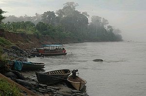 Madre de Dios near Boca Manú town, Peru | |
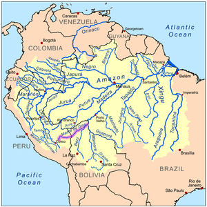 The Amazon Basin with the Madre de Dios River highlighted | |
| Location | |
| Country | Bolivia, Peru |
| Physical characteristics | |
| Source | |
| • location | Cordillera Vilcanota, Peru |
| Mouth | Madeira River |
• location | Villa Bella, Beni, Bolivia |
| Length | 1,347 km (837 mi) |
| Basin size | 281,000 km2 (108,000 sq mi) |
| Discharge | |
| • location | Miraflores-El Sena |
| • average | 5,800 m3/s (200,000 cu ft/s)[1] |
| Discharge | |
| • location | Near mouth |
| • average | 9,350 m3/s (330,000 cu ft/s) |
The Madre de Dios River (Spanish pronunciation: [ˈmaðɾe ðe ðjos]) is a river shared by Bolivia and Peru which is homonymous to the Peruvian region it runs through. On Bolivian territory it receives the Beni River, close to the town of Riberalta, which later joins with the Mamore River to become the Madeira River after the confluence. The Madeira is a tributary to the Amazon River.
The Madre de Dios is an important waterway for the department of Madre de Dios, particularly Puerto Maldonado, the largest town in the area, and the capital of the department. Mango farming and gold mining are among the many industries on its beaches. Other important industries the Madre de Dios provides are selective logging and farming, both of which are serious environmental problems. Along the length of the river there are several national parks and reserves, notably Tambopata-Candamo National Park, Manú National Park (also known as Manú Biosphere Reserve) and Bahuaja-Sonene National Park.
Hydrography[]
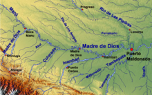
The Madre de Dios serves as the largest watershed in the area, as part of the vast Amazon River watershed. The river's main tributaries include on the right: Chivile, Azul, Blanco, Inambari, Tambopata and Colorado rivers and from the left: Los Amigos, Manú, and Las Piedras.[2]

References[]
- ^ [1]
- ^ Evaluacion Ambiental Territorial en la Zona Aurifera de Madre de Dios Archived 2008-12-17 at the Wayback Machine, 4. Climatología E Hidrologia Archived 2008-09-13 at the Wayback Machine {es} Ministry of Energy and Mines, Peruvian Government, December 1997.
External links[]
- Madre de Dios Watershed at NASA Earth Observatory
- Stroud Water Research Center Project in Madre de Dios, Peru
Coordinates: 12°17′S 70°52′W / 12.283°S 70.867°W

| hide Authority control | |
|---|---|
| General |
|
| National libraries | |
- Rivers of Peru
- International rivers of South America
- Rivers of Beni Department
- Rivers of Pando Department
- Rivers of Madre de Dios Region