Mae Chai District
Mae Chai
แม่ใจ | |
|---|---|
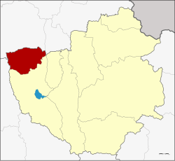 District location in Phayao Province | |
| Coordinates: 19°20′42″N 99°48′54″E / 19.34500°N 99.81500°ECoordinates: 19°20′42″N 99°48′54″E / 19.34500°N 99.81500°E | |
| Country | Thailand |
| Province | Phayao |
| Seat | Si Thoi |
| Subdistricts | 6 |
| Mubans | 65 |
| Area | |
| • Total | 300.761 km2 (116.124 sq mi) |
| Population (2005) | |
| • Total | 36,089 |
| • Density | 120.0/km2 (311/sq mi) |
| Time zone | UTC+7 (ICT) |
| Postal code | 56130 |
| Geocode | 5607 |

Mae Chai District (Thai: แม่ใจ, pronounced [mɛ̂ː t͡ɕāj]) is a district (amphoe) of Phayao Province in northern Thailand.
History[]
The District Mae Chai was abolished on 23 December 1917 and was incorporated into .[1] It was recreated as a minor district (king amphoe) on 24 January 1963.[2] It was upgraded to a full district on 28 July 1965.[3] In 1977 the district was reassigned from Chiang Rai Province to the newly established Phayao Province.
Geography[]
The district is in the upper valley of the Ing River. West of the town Mae Chai is the 1,426 m high mountain of the Phi Pan Nam Range. It rises within a protected area in the Doi Luang National Park. To the east is the Nong Liang Sai Reservoir, and at the boundary to the Mueang District the Mae Pim Reservoir. protects the Mae Puem National Conserved Forest and Dong Pradu Forest.
Neighboring districts are (from the north clockwise): Phan and Pa Daet of Chiang Rai Province; Mueang Phayao of Phayao Province; and Wang Nuea of Lampang Province.
Administration[]
The district is divided into six sub-districts (tambons), which are further subdivided into 65 villages (mubans). The township (thesaban tambon) Mae Chai covers parts of tambons Mae Chai and Si Thoi. There are a further six tambon administrative organizations (TAO).
| No. | Name | Thai name | Villages | Pop. | |
|---|---|---|---|---|---|
| 1. | Mae Chai | แม่ใจ | 10 | 5,094 | |
| 2. | Si Thoi | ศรีถ้อย | 13 | 7,267 | |
| 3. | แม่สุก | 10 | 5,830 | ||
| 4. | Pa Faek | ป่าแฝก | 10 | 5,538 | |
| 5. | Ban Lao | บ้านเหล่า | 14 | 8,219 | |
| 6. | Charoen Rat | เจริญราษฎร์ | 8 | 4,141 |
References[]
- ^ ประกาศกระทรวงมหาดไทย เรื่อง ให้ยุบอำเภอแม่ใจและอำเภอดอกคำใต้ (PDF). Royal Gazette (in Thai). 34 (ก): 505. December 23, 1917.
- ^ ประกาศกระทรวงมหาดไทย เรื่อง แบ่งท้องที่ตั้งเป็นกิ่งอำเภอ (PDF). Royal Gazette (in Thai). 80 (14 ง): 221–222. February 5, 1963.
- ^ พระราชกฤษฎีกาตั้งอำเภอศรีสวัสดิ์ อำเภอสังขละบุรี อำเภอท่าคันโท อำเภอดอกคำใต้ อำเภอแม่ใจ อำเภอจุน อำเภอขามทะเลสอ อำเภอไพศาลี อำเภอท่าวังผา อำเภอบ้านกรวด อำเภอเด่นชัย อำเภอปทุมรัตต์ อำเภอกะเปอร์ อำเภออากาศอำนวย อำเภอดอนเจดีย์ อำเภอจอมพระ และอำเภอสามโก้ พ.ศ. ๒๕๐๘ (PDF). Royal Gazette (in Thai). 81 (49 ก): 565–569. July 27, 1965.
External links[]
This Phayao Province location article is a stub. You can help Wikipedia by . |
- Amphoe of Phayao Province
- Northern Thailand geography stubs