Maine (river)
| Maine | |
|---|---|
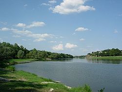 The Maine near Angers | |
| Native name | La Maine (French) |
| Location | |
| Country | France |
| Physical characteristics | |
| Source | |
| • location | Sarthe and Mayenne |
| • elevation | ±25 m (82 ft) |
| Mouth | |
• location | Loire |
• coordinates | 47°24′39″N 0°36′53″W / 47.41083°N 0.61472°WCoordinates: 47°24′39″N 0°36′53″W / 47.41083°N 0.61472°W |
| Length | 11.5 km (7.1 mi) |
| Basin size | 22,194 km2 (8,569 sq mi) |
| Discharge | |
| • average | 128 m3/s (4,500 cu ft/s) |
| Basin features | |
| Progression | Loire→ Atlantic Ocean |

The Maine (French pronunciation: [mɛːn] (![]() listen)) is a river, a tributary of the Loire, 11.5 km (7.1 mi) long, in the Maine-et-Loire département in France.[1]
listen)) is a river, a tributary of the Loire, 11.5 km (7.1 mi) long, in the Maine-et-Loire département in France.[1]
It is formed by the confluence of the Mayenne and Sarthe rivers north of Angers. It flows through this city and joins the Loire south-west of Angers.
The river's name is derived from the ancient Meodena, and is unrelated to Maine, the province.
References[]
External links[]
| Wikimedia Commons has media related to Maine River. |
| Authority control |
|---|
This Maine-et-Loire geographical article is a stub. You can help Wikipedia by . |
Categories:
- Tributaries of the Loire
- Rivers of France
- Maine basin
- Rivers of Maine-et-Loire
- Rivers of Pays de la Loire
- Maine-et-Loire geography stubs
- France river stubs