Maja e zezë
| Maja e zezë | |
|---|---|
| Crn Vrv | |
 | |
| Highest point | |
| Elevation | 2,528 m (8,294 ft) |
| Coordinates | 42°7′45″N 20°55′10″E / 42.12917°N 20.91944°ECoordinates: 42°7′45″N 20°55′10″E / 42.12917°N 20.91944°E |
| Geography | |
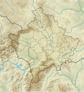 Maja e zezë Location of the peak | |
| Location | North Macedonia, and Republic of Kosovo |
| Parent range | Šar Mountains |

Maja e Zezë (Macedonian: Црн Врв, romanized: Crn Vrv; Serbo-Croatian: Црни Врх / Crni Vrh, Островица Планина / Ostrovica Planina) (meaning black peak) is a mountain in Kosovo[a] and North Macedonia.[1][2] It is part of the Šar Mountains range and is 2,585 m (8,481 ft) high. To the east of the mountain is Peskovi (2,651 m or 8,698 ft), and to the west of it is Kobilica (2,528 m or 8,294 ft).[3]
Notes[]
| a. | ^ Kosovo is the subject of a territorial dispute between the Republic of Kosovo and the Republic of Serbia. The Republic of Kosovo unilaterally declared independence on 17 February 2008. Serbia continues to claim it as a part of its own sovereign territory. The two governments began to normalise relations in 2013, as part of the 2013 Brussels Agreement. Kosovo is currently recognised as an independent state by 97 out of the 193 United Nations member states. In total, 112 UN member states have recognised Kosovo at some point, of which 15 states later withdrew their recognition. |
References:
- ^ Škariḱ, Mihajlovska, Svetomir, Nadica (2002). Law, force, and peace - Macedonia and Kosovo. Tri D. ISBN 9789989677038.
- ^ Talevski, Jove Dimitrija (1998). The borders of the Republic of Macedonia. Kiro Dandaro. ISBN 9789989785092. Retrieved April 4, 2014.
- ^ Душан Кривокапиќ: „Шар-Планина“, издание на „Туристичка Штампа“, Белград, 1969 година
This Kosovo location article is a stub. You can help Wikipedia by . |
Categories:
- Šar Mountains
- Two-thousanders of Kosovo
- Two-thousanders of North Macedonia
- Kosovo geography stubs