Makhu
Makhu | |
|---|---|
Town | |
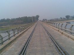 Rail Road bridge near Makhu | |
 Makhu Location in Punjab, India | |
| Coordinates: 31°06′N 75°00′E / 31.1°N 75.0°ECoordinates: 31°06′N 75°00′E / 31.1°N 75.0°E | |
| Country | India |
| State | Punjab |
| District | Ferozepur |
| Government | |
| • Type | Nagar Panchayat |
| Area | |
| • Total | 6 km2 (2 sq mi) |
| Elevation | 201 m (659 ft) |
| Population (2011) | |
| • Total | 14,658 |
| • Density | 2,400/km2 (6,300/sq mi) |
| Lanuguages | |
| • Official | Punjabi |
| Time zone | UTC+5:30 (IST) |
| PIN | 142044 |
| Telephone code | 01682 |
| Vehicle registration | PB 47 |


Makhu is a town and a nagar panchayat in Ferozepur district in [1] Indian state of Punjab.
Geography[]
Makhu has an average elevation of 201 metres (659 feet).[1] This town is located near the edge of Harike Sanctuary. It is 5 km away from the confluence of Satluj and Beas rivers.
Demographics[]
As of 2001 India census,[2] Makhu had a population of 12,173. Males constitute 52% of the population and females 48%. Makhu has an average literacy rate of 61%, higher than the national average of 59.5%: male literacy is 65%, and female literacy is 56%. In Makhu, 14% of the population is under 6 years of age.
Transport[]
- Air
Makhu is located 63 km from Amritsar International Airport.
- Railway
The town has namesake Makhu Railway station which provides connectivity to major cities of Firozpur, Ludhiana and Jalandhar.
- Road
Makhu town is connected to rest of Punjab and nation through three national highways.
References[]
- ^ Falling Rain Genomics, Inc - Makhu
- ^ "Census of India 2001: Data from the 2001 Census, including cities, villages and towns (Provisional)". Census Commission of India. Archived from the original on 16 June 2004. Retrieved 1 November 2008.
This article about a location in the Indian state of Punjab is a stub. You can help Wikipedia by . |
- Cities and towns in Firozpur district
- Punjab, India geography stubs