Mali i Kulmakut
| Mali i Kulmakut | |
|---|---|
 Mali i Kulmakut | |
| Highest point | |
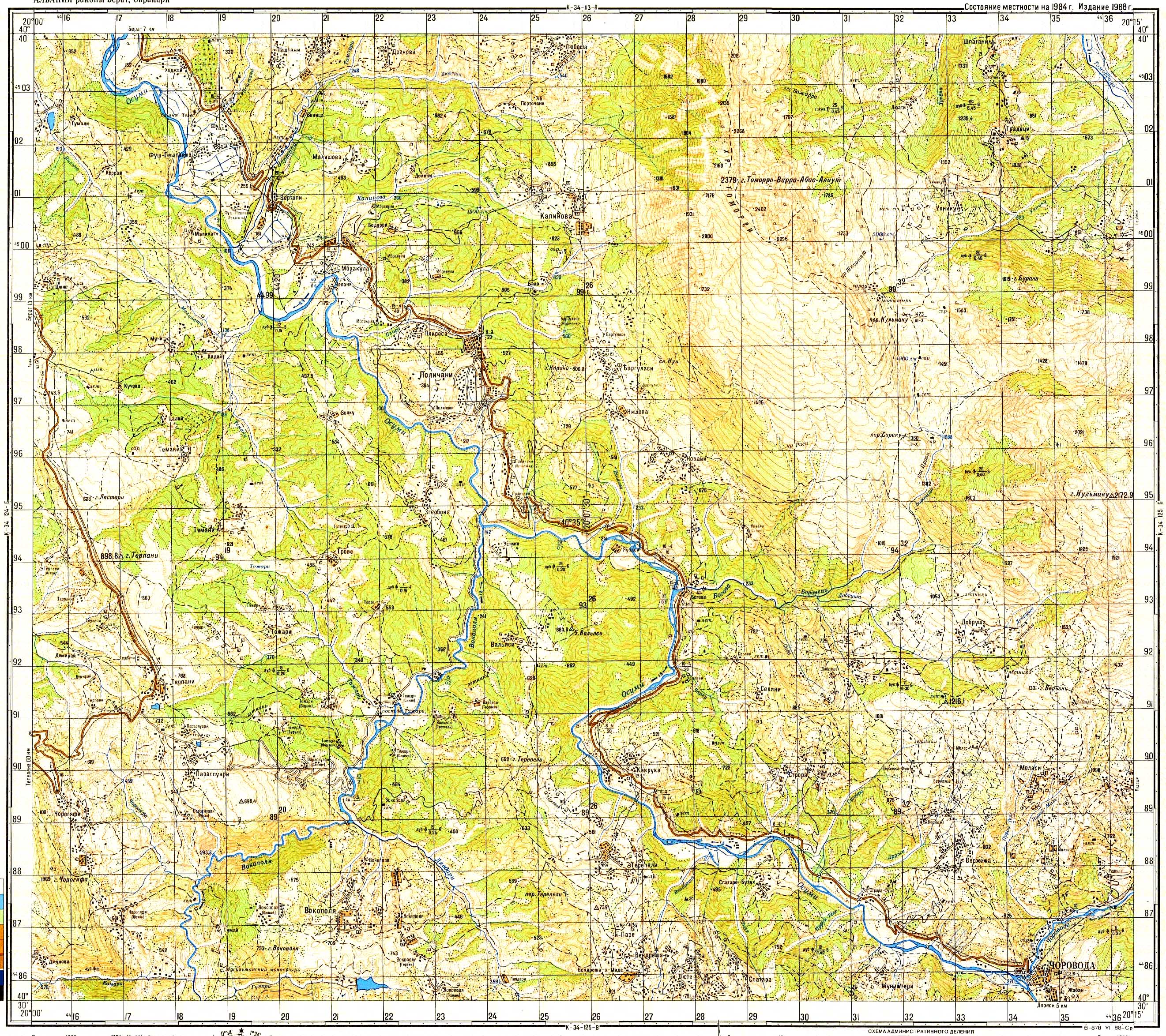
| Elevation | 2,173 m (7,129 ft) |
| Coordinates | 40°35′13″N 20°14′38″E / 40.5869°N 20.2439°ECoordinates: 40°35′13″N 20°14′38″E / 40.5869°N 20.2439°E |
| Geography | |
| Location | Albania |
| Parent range | Tomorr |

Mali i Kulmakut is a peak in the southeastern part of the Tomorr range in Albania. It has an elevation of 2,173 m (7,129 ft) above sea level.[1]
References[]
- ^ Soviet military map K-34-125-А (1:50,000)
This article about a specific location in Berat County, Albania, is a stub. You can help Wikipedia by . |
Categories:
- Berat County geography stubs
- Mountains of Albania