Malnesberget
| Malnesberget | |
|---|---|
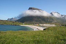 Malnesberget seen from Hovden | |
| Highest point | |
| Elevation | 529 m (1,736 ft)[1] |
| Coordinates | 68°47′57″N 14°33′58″E / 68.7993°N 14.5662°ECoordinates: 68°47′57″N 14°33′58″E / 68.7993°N 14.5662°E[2] |
| Geography | |
 Malnesberget Location of the mountain | |
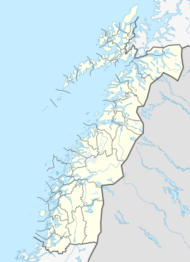
| Location | Nordland, Norway |
| Climbing | |
| Easiest route | From below Tussen near Malnes |


Malnesberget (Mount Malnes) is a 529-meter (1,736 ft)[1] mountain in the municipality of Bø in Nordland county, Norway. The mountain stands on the western side of the large island of Langøya, along the Malnesfjorden, just south of the villages of Hovden and Malnes (hence the name).[2] It can be climbed from the village of Malnes starting about 500 meters (1,600 ft) north of Tussen (elevation: 198 meters or 650 feet), a smaller hill located along Norwegian County Road 915, just west of Malnesberget.
References[]
- ^ a b "Malnesberget" (in Norwegian). Statens kartverk Norgeskart.no.
- ^ a b "Malnesberget, Bø (Nordland)" (in Norwegian). yr.no. Retrieved 2018-12-29.
This article about a mountain, mountain range, or peak in Nordland is a stub. You can help Wikipedia by . |
Categories:
- Hills of Norway
- Mountains of Nordland
- Bø, Nordland
- Mountains under 1000 metres
- Norway mountain stubs
- Nordland geography stubs