Mandelbachtal
Mandelbachtal | |
|---|---|
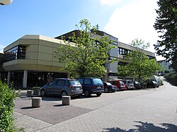 Town hall in Ormesheim | |
 Coat of arms | |
show Location of Mandelbachtal within Saarpfalz district | |
 Mandelbachtal | |
| Coordinates: 49°10′N 7°10′E / 49.167°N 7.167°ECoordinates: 49°10′N 7°10′E / 49.167°N 7.167°E | |
| Country | Germany |
| State | Saarland |
| District | Saarpfalz |
| Government | |
| • Mayor (2019–24) | Maria Vermeulen[1] (SPD) |
| Area | |
| • Total | 57.71 km2 (22.28 sq mi) |
| Elevation | 450 m (1,480 ft) |
| Population (2020-12-31)[2] | |
| • Total | 10,513 |
| • Density | 180/km2 (470/sq mi) |
| Time zone | UTC+01:00 (CET) |
| • Summer (DST) | UTC+02:00 (CEST) |
| Postal codes | 66399 |
| Dialling codes | 06803 06804 06893 |
| Vehicle registration | HOM |
| Website | www |


Mandelbachtal is a municipality in the Saarpfalz district, in Saarland, Germany. It is situated near the border with France, approx. 15 km southeast of Saarbrücken. Its capital is .
Community organization[]
Mandelbachtal is composed of the communities of Bebelsheim, Bliesmengen-Bolchen, Erfweiler-Ehlingen, Habkirchen, Heckendalheim, Ommersheim, Ormesheim, and Wittersheim.
Name[]
The municipality of Mandelbachtal was formed in 1974. The name is derived from the valley of the Mandelbach, in which four of the eight communities composing the town are located: Erfweiler-Ehlingen, Wittersheim, Bebelsheim und Habkirchen. From the headwaters to the mouth of the Mandelbach there are many pollarded willows, Kopfweiden, also called Korbweiden ("basket willows"). From the shoots of these willows in previous centuries people wove baskets necessary for local agriculture. Because the willow leaves resembled those of the almond the tree was colloquially called Mandelbaum ("almond"). This is where the neighboring stream of the Mandelbach derived its name. Near the confluence of the Mandelbach and the Blies there was formerly a town named Mandelbach, first recorded in 1239, which is today a neighborhood of Habkirchen. In 1974, during the reform of administrative districts in Saarland, today's Mandelbachtal was formed by the consolidation of eight formerly independent communities.
References[]
- ^ Gewählte Ober-/Bürgermeister*innen, Landrät*innen und Regionalverbandsdirektor*in im Saarland, accessed 19 June 2021.
- ^ "Saarland.de – Amtliche Einwohnerzahlen Stand 31. Dezember 2020" (PDF). Statistisches Amt des Saarlandes (in German). June 2021.
| Wikimedia Commons has media related to Mandelbachtal. |
| show Authority control |
|---|
This Saarland location article is a stub. You can help Wikipedia by . |
- Municipalities in Saarland
- Saarpfalz-Kreis
- Palatinate (region)
- Saarland geography stubs