Mander, Overijssel
Coordinates: 52°27′N 6°50′E / 52.450°N 6.833°E
Mander
Maander (Twents) | |
|---|---|
 | |
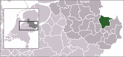
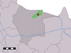
 The village (dark red) and the statistical district (light green) of Mander in the municipality of Tubbergen. | |
| Coordinates: 52° 27' NB, 6° 49' OL | |
| Country | Netherlands |
| Province | Overijssel |
| Municipality | Tubbergen |
| Population | 400 |
| Demonym(s) | Grupndrieters |
Mander (Tweants: Maander) is a village in the Dutch province of Overijssel. It is a part of the municipality of Tubbergen, and lies about 15 km northeast of Almelo.
The statistical area "Mander", which also can include the surrounding countryside, has a population of around 390.[1]
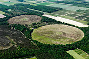
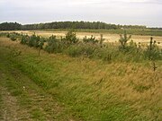
Among the points of special interest are two watermills, some hidden tumuli and the land art project 'Mander Circles' by Paul de Kort.
Gallery[]
Tumuli near mander
Bels' watermill

Mander circles

Mander circles
References[]
- ^ Statistics Netherlands (CBS), Statline: Kerncijfers wijken en buurten 2003-2005. As of 1 January 2005.
Categories:
- Populated places in Overijssel
- Twente
- Tubbergen
- Overijssel geography stubs


