Mango, Togo
Mango | |
|---|---|
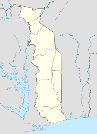 Mango Location in Togo | |
| Coordinates: 10°21′20″N 0°28′32″E / 10.35556°N 0.47556°E | |
| Country | |
| Region | Savanes Region |
| Population (2007) | |
| • Total | 41,464 |

Mango, formerly Sansanné-Mango , is a city in northern Togo. It is situated on the Oti River in the Savanes Region. The town is located near Kéran National Park and 26 kilometres (16 mi) from the border with Ghana. The population is about 41,464 people (2007).[1]
Climate[]
| hideClimate data for Mango, Togo (Sansanné-Mango Airport) | |||||||||||||
|---|---|---|---|---|---|---|---|---|---|---|---|---|---|
| Month | Jan | Feb | Mar | Apr | May | Jun | Jul | Aug | Sep | Oct | Nov | Dec | Year |
| Record high °C (°F) | 40.9 (105.6) |
41.9 (107.4) |
44.4 (111.9) |
42.1 (107.8) |
41.0 (105.8) |
38.0 (100.4) |
36.0 (96.8) |
34.2 (93.6) |
34.4 (93.9) |
37.2 (99.0) |
39.0 (102.2) |
39.6 (103.3) |
44.4 (111.9) |
| Average high °C (°F) | 36.0 (96.8) |
37.8 (100.0) |
39.1 (102.4) |
38.0 (100.4) |
35.5 (95.9) |
32.2 (90.0) |
30.5 (86.9) |
29.5 (85.1) |
30.6 (87.1) |
32.9 (91.2) |
35.7 (96.3) |
35.6 (96.1) |
34.5 (94.1) |
| Daily mean °C (°F) | 26.8 (80.2) |
29.4 (84.9) |
31.5 (88.7) |
31.4 (88.5) |
29.6 (85.3) |
27.5 (81.5) |
26.4 (79.5) |
26.0 (78.8) |
26.4 (79.5) |
27.9 (82.2) |
27.9 (82.2) |
26.7 (80.1) |
28.1 (82.6) |
| Average low °C (°F) | 18.0 (64.4) |
21.0 (69.8) |
24.4 (75.9) |
25.3 (77.5) |
24.1 (75.4) |
22.5 (72.5) |
21.9 (71.4) |
21.9 (71.4) |
21.6 (70.9) |
21.7 (71.1) |
19.4 (66.9) |
18.1 (64.6) |
21.5 (70.7) |
| Record low °C (°F) | 12.1 (53.8) |
15.0 (59.0) |
18.0 (64.4) |
18.2 (64.8) |
18.9 (66.0) |
18.8 (65.8) |
18.8 (65.8) |
19.5 (67.1) |
17.4 (63.3) |
17.8 (64.0) |
14.5 (58.1) |
13.8 (56.8) |
12.1 (53.8) |
| Average precipitation mm (inches) | 0.23 (0.01) |
4.13 (0.16) |
28.58 (1.13) |
66.07 (2.60) |
106.12 (4.18) |
136.62 (5.38) |
195.87 (7.71) |
236.70 (9.32) |
235.51 (9.27) |
69.10 (2.72) |
5.53 (0.22) |
3.40 (0.13) |
1,087.9 (42.83) |
| Average precipitation days (≥ 1.0 mm) | 0 | 1 | 2 | 4 | 7 | 10 | 12 | 14 | 15 | 6 | 0 | 0 | 71 |
| Average relative humidity (%) | 27 | 28 | 40 | 58 | 69 | 78 | 83 | 85 | 84 | 77 | 54 | 35 | 59 |
| Mean monthly sunshine hours | 270.0 | 247.1 | 253.9 | 237.3 | 250.1 | 214.4 | 169.4 | 147.2 | 171.7 | 256.2 | 271.4 | 257.7 | 2,746.4 |
| Source 1: Deutscher Wetterdienst[2] | |||||||||||||
| Source 2: NOAA (precipitation 1957–1986 and sun 1961–1990)[3] | |||||||||||||
Economy[]
The town is a trading center for cattle and peanuts.[4]
Transportation[]
The town lies on the main North-South road (Route Nationale No. 1) in Togo.[4]
Demography[]
The town is mainly inhabited by Chakosi people.[4]
Health[]
In 2014, the constructed a hospital (Hospital of Hope) in Mango and it opened the facility in Feb 2015.[5]
References[]
- ^ "The World Gazetteer". Archived from the original on January 5, 2013.. Retrieved February 19, 2007
- ^ "Klimatafel von Mango (Sansane-Mango) / Togo" (PDF). Baseline climate means (1961–1990) from stations all over the world (in German). Deutscher Wetterdienst. Retrieved 18 December 2018.
- ^ "Sansanne–Mango Climate Normals 1961–1990". National Oceanic and Atmospheric Administration. Retrieved 18 December 2018.
- ^ Jump up to: a b c Mango at the Encyclopædia Britannica
- ^ Hospital of Hope website, http://hohmango.org/
External links[]
Coordinates: 10°21′20″N 0°28′32″E / 10.35556°N 0.47556°E
| show Authority control |
|---|
This Togo location article is a stub. You can help Wikipedia by . |
Categories:
- Populated places in Savanes Region, Togo
- Togo geography stubs