Maradi Airport
Maradi Airport | |||||||||||
|---|---|---|---|---|---|---|---|---|---|---|---|
| Summary | |||||||||||
| Airport type | Public | ||||||||||
| Serves | Maradi, Niger | ||||||||||
| Elevation AMSL | 1,240 ft / 378 m | ||||||||||
| Coordinates | 13°30′10″N 7°07′30″E / 13.50278°N 7.12500°ECoordinates: 13°30′10″N 7°07′30″E / 13.50278°N 7.12500°E | ||||||||||
| Map | |||||||||||
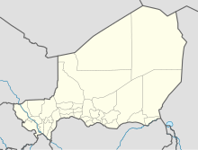 MFQ Location of the airport in Niger | |||||||||||
| Runways | |||||||||||
| |||||||||||
Maradi Airport (IATA: MFQ, ICAO: DRRM) is an airport serving Maradi, Niger. The airport is on the east side of the city.
The Maradi non-directional beacon (Ident: MY) is located on the field.[3]
Airlines and destinations[]
| Airlines | Destinations |
|---|---|
| Niger Airlines | Niamey |
See also[]
- Transport in Niger
- List of airports in Niger
 Aviation portal
References[]
- ^ Google Maps - Maradi
- ^ "Maradi Airport". SkyVector. Retrieved 1 July 2019.
- ^ "Maradi NDB". World Aero Data. Retrieved 1 July 2019.
External links[]
This Niger location article is a stub. You can help Wikipedia by . |
This article about an airport in Niger is a stub. You can help Wikipedia by . |
Categories:
- Airports in Niger
- Buildings and structures in Maradi, Niger
- Niger geography stubs
- West African airport stubs
- Niger stubs