Mari, Syria
تل حريري (in Arabic) | |
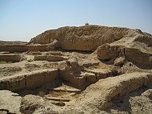 Ruins of Mari | |
 Shown within Syria | |
| Alternative name | Tell Hariri |
|---|---|
| Location | Abu Kamal, Deir ez-Zor Governorate, Syria |
| Coordinates | 34°32′58″N 40°53′24″E / 34.54944°N 40.89000°ECoordinates: 34°32′58″N 40°53′24″E / 34.54944°N 40.89000°E |
| Type | Settlement |
| Area | 60 hectares (150 acres) |
| History | |
| Founded | c. 2900 BC |
| Abandoned | 3rd century BC |
| Periods | Bronze Age |
| Cultures | East-Semitic (Kish civilization), Amorite |
| Site notes | |
| Archaeologists | André Parrot |
| Condition | Ruined |
| Ownership | Public |
| Public access | Yes |


Mari (Cuneiform: