Marquette, Manitoba
Marquette | |
|---|---|
 Marquette Location of Marquette in Manitoba | |
| Coordinates: 50°3′52″N 97°43′58″W / 50.06444°N 97.73278°WCoordinates: 50°3′52″N 97°43′58″W / 50.06444°N 97.73278°W | |
| Country | |
| Province | |
| Region | Interlake Region |
| Census Division | No. 14 |
| Government | |
| • Governing Body | Rural Municipality of Woodlands Council |
| • MP | James Bezan |
| • MLA | Ralph Eichler |
| Time zone | UTC−6 (CST) |
| • Summer (DST) | UTC−5 (CDT) |
| Postal Code | R0H 0V0 |
| Area code(s) | 204, 431 |
| NTS Map | 062I04 |
| GNBC Code | GAQFT |
| Website | http://www.rmwoodlands.info |

Marquette is an unincorporated community in the Rural Municipality of Woodlands in the Interlake Region of Manitoba, Canada. It is located approximately 46 kilometres (29 miles) northwest of Winnipeg.[1]
History[]
The post office opened in 1871 as Baie St. Paul, changed to Marquette in 1891. The community was first noted as Marquette Station in 1882, named for French-born Jesuit missionary Jacques Marquette.[2]
Climate[]
Marquette experiences a humid continental climate (Köppen Dfb[3]) with warm to hot summers and cold winters.
| Climate data for Marquette | |||||||||||||
|---|---|---|---|---|---|---|---|---|---|---|---|---|---|
| Month | Jan | Feb | Mar | Apr | May | Jun | Jul | Aug | Sep | Oct | Nov | Dec | Year |
| Record high °C (°F) | 8 (46) |
9.4 (48.9) |
17.2 (63.0) |
36.1 (97.0) |
37.8 (100.0) |
38 (100) |
35 (95) |
38.5 (101.3) |
37.5 (99.5) |
31 (88) |
23.9 (75.0) |
10.6 (51.1) |
38.5 (101.3) |
| Average high °C (°F) | −12.6 (9.3) |
−8.1 (17.4) |
−0.9 (30.4) |
10.1 (50.2) |
19.3 (66.7) |
23.3 (73.9) |
25.6 (78.1) |
24.9 (76.8) |
18.5 (65.3) |
10.8 (51.4) |
−0.9 (30.4) |
−9.8 (14.4) |
8.4 (47.1) |
| Daily mean °C (°F) | −17.5 (0.5) |
−13.2 (8.2) |
−5.8 (21.6) |
4.1 (39.4) |
12.4 (54.3) |
17.1 (62.8) |
19.6 (67.3) |
18.6 (65.5) |
12.6 (54.7) |
5.6 (42.1) |
−4.9 (23.2) |
−14.3 (6.3) |
2.9 (37.2) |
| Average low °C (°F) | −22.3 (−8.1) |
−18.2 (−0.8) |
−10.7 (12.7) |
−1.9 (28.6) |
5.5 (41.9) |
10.9 (51.6) |
13.5 (56.3) |
12.1 (53.8) |
6.7 (44.1) |
0.4 (32.7) |
−8.9 (16.0) |
−18.8 (−1.8) |
−2.6 (27.3) |
| Record low °C (°F) | −39.5 (−39.1) |
−41 (−42) |
−33.3 (−27.9) |
−27.8 (−18.0) |
−9 (16) |
−0.5 (31.1) |
2.8 (37.0) |
1.1 (34.0) |
−5 (23) |
−19 (−2) |
−35 (−31) |
−39.5 (−39.1) |
−41 (−42) |
| Average precipitation mm (inches) | 23.3 (0.92) |
18.3 (0.72) |
26.6 (1.05) |
32.7 (1.29) |
57.8 (2.28) |
87.3 (3.44) |
73.1 (2.88) |
70.5 (2.78) |
57 (2.2) |
39.1 (1.54) |
29.6 (1.17) |
23.5 (0.93) |
538.8 (21.21) |
| Source: Environment Canada[4] | |||||||||||||
References[]
- ^ "Geographical Names of Canada - Querying Distances". nrcan.gc.ca. 2011-10-24. Archived from the original on 2013-01-01. Retrieved 2012-10-30.
- ^ "Geographical Names of Manitoba" (PDF). Government of Manitoba. 2000. Retrieved August 28, 2021.
- ^ "Updated world map of the Köppen-Geiger climate classification" (PDF). University of Melbourne. Retrieved February 2, 2012.
- ^ Environment Canada Canadian Climate Normals 1971–2000, accessed 18 February 2014
Division No. 14, Manitoba (South Interlake) | ||
|---|---|---|
| Towns | 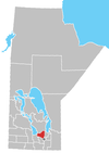 | |
| Rural municipalities | ||
| Unincorporated communities | ||
This Manitoba location article is a stub. You can help Wikipedia by . |
Categories:
- Unincorporated communities in Manitoba
- Manitoba geography stubs