Marshland, New Zealand
Marshland | |
|---|---|
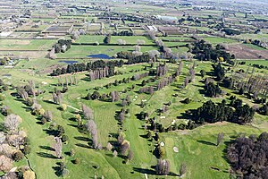 Windsor Golf Course with Marshland in the distance | |
 | |
| Coordinates: 43°28′30″S 172°39′07″E / 43.475°S 172.652°ECoordinates: 43°28′30″S 172°39′07″E / 43.475°S 172.652°E | |
| Country | New Zealand |
| City | Christchurch |
| Local authority | Christchurch City Council |
| Electoral ward | Innes |
| Area | |
| • Land | 1,011 ha (2,498 acres) |
| Population (June 2021)[2] | |
| • Total | 910 |

| Belfast | Kainga | Bottle Lake |
| Redwood |
|
Prestons |
| Northcote | Mairehau | Shirley |
Marshland is a semi-rural suburb on the northern side of Christchurch city. The land is primarily used for horticulture and dairy farming.[3]
The suburb is named for the peaty soil, and was also called Rhodes' Swamp after landowner and politician Robert Heaton Rhodes (1815–1884).[4]
State Highway 74 forms the western and southern boundary of the suburb. The Styx River runs northeast through Marshland.[5]
Demographics[]
Marshland covers 10.11 km2 (3.90 sq mi).[1] It had an estimated population of 910 as of June 2021,[2] with a population density of 90 people per km2.
| Year | Pop. | ±% p.a. |
|---|---|---|
| 2006 | 783 | — |
| 2013 | 759 | −0.44% |
| 2018 | 789 | +0.78% |
| Source: [6] | ||
Marshland had a population of 789 at the 2018 New Zealand census, an increase of 30 people (4.0%) since the 2013 census, and an increase of 6 people (0.8%) since the 2006 census. There were 258 households. There were 408 males and 381 females, giving a sex ratio of 1.07 males per female. The median age was 41.1 years (compared with 37.4 years nationally), with 135 people (17.1%) aged under 15 years, 162 (20.5%) aged 15 to 29, 387 (49.0%) aged 30 to 64, and 105 (13.3%) aged 65 or older.
Ethnicities were 87.5% European/Pākehā, 12.5% Māori, 1.5% Pacific peoples, 7.6% Asian, and 1.1% other ethnicities (totals add to more than 100% since people could identify with multiple ethnicities).
The proportion of people born overseas was 16.3%, compared with 27.1% nationally.
Although some people objected to giving their religion, 50.6% had no religion, 40.3% were Christian, 0.4% were Muslim, 0.8% were Buddhist and 1.5% had other religions.
Of those at least 15 years old, 111 (17.0%) people had a bachelor or higher degree, and 120 (18.3%) people had no formal qualifications. The median income was $37,700, compared with $31,800 nationally. The employment status of those at least 15 was that 330 (50.5%) people were employed full-time, 96 (14.7%) were part-time, and 18 (2.8%) were unemployed.[6]
Education[]
Marshland School is a full primary school catering for years 1 to 8.[7] It had a roll of 541 as of November 2021.[8] The school opened in 1888.[9]
References[]
- ^ a b "ArcGIS Web Application". statsnz.maps.arcgis.com. Retrieved 10 September 2021.
- ^ a b "Population estimate tables - NZ.Stat". Statistics New Zealand. Retrieved 22 October 2021.
- ^ "Marshland". New Zealand Ministry for Culture and Heritage. Retrieved 10 September 2021.
- ^ "Christchurch Place Names: A - M : Islington" (PDF). Christchurch City Libraries. February 2016. p. 179.
- ^ Harriss, Gavin (April 2021). Marshland, Canterbury (Map).
- ^ a b "Statistical area 1 dataset for 2018 Census". Statistics New Zealand. March 2020. Marshland (318400). 2018 Census place summary: Marshland
- ^ Education Counts: Marshland School
- ^ "New Zealand Schools Directory". New Zealand Ministry of Education. Retrieved 22 December 2021.
- ^ "Miscellaneous Local Historical Information" (PDF). Christchurch City Libraries. p. 103. Retrieved 10 September 2021.
- Suburbs of Christchurch
- Populated places in Canterbury, New Zealand