Maryland Route 508
 | ||||
|---|---|---|---|---|
| Adelina Road | ||||
 | ||||
| Route information | ||||
| Maintained by MDSHA | ||||
| Length | 1.20 mi[1] (1.93 km) | |||
| Existed | 1933–present | |||
| Major junctions | ||||
| South end | ||||
| North end | ||||
| Location | ||||
| Counties | Calvert | |||
| Highway system | ||||
| ||||
| ||||
Maryland Route 508 (MD 508) is a state highway in the U.S. state of Maryland. Known as Adelina Road, the state highway runs 1.20 miles (1.93 km) from MD 506 in Bowens north to MD 231 near Barstow. MD 508 was constructed in the early 1930s from MD 231 to Adelina. The southern terminus was rolled back to Bowens in the late 1950s.
Route description[]
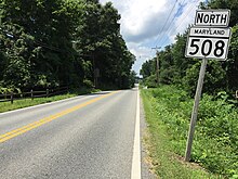
MD 508 begins at a four-way intersection in Bowens. Sixes Road heads east as MD 506 toward Port Republic and west as a county highway toward the Patuxent River. Adelina Road continues south as a county highway toward the unincorporated community of Adelina and the historic home Taney Place, which was the birthplace of Supreme Court Chief Justice Roger Taney. MD 508 heads north as a two-lane undivided road through a forested area with scattered residences. The state highway reaches its northern terminus at MD 231 (Hallowing Point Road) near Barstow.[1][2]
History[]
MD 508 was constructed from MD 231 south to Sheridan Point Road in Adelina in 1933.[3][4] The southern terminus was rolled back to MD 506 in Bowens in 1957.[5]
Junction list[]
The entire route is in Calvert County.
| Location | mi[1] | km | Destinations | Notes | |
|---|---|---|---|---|---|
| Bowens | 0.00 | 0.00 | Southern terminus; western terminus of MD 506 | ||
| Barstow | 1.20 | 1.93 | Northern terminus | ||
| 1.000 mi = 1.609 km; 1.000 km = 0.621 mi | |||||
See also[]
 Maryland Roads portal
References[]
- ^ a b c Highway Information Services Division (December 31, 2013). Highway Location Reference. Maryland State Highway Administration. Retrieved 2011-02-21.
- Calvert County (PDF).
- ^ Google (2011-02-21). "Maryland Route 508" (Map). Google Maps. Google. Retrieved 2011-02-21.
- ^ Byron, William D.; Lacy, Robert (December 28, 1934). Report of the State Roads Commission of Maryland (1931–1934 ed.). Baltimore: Maryland State Roads Commission. p. 32. Retrieved 2011-02-21.
- ^ Maryland Geological Survey (1933). Map of Maryland Showing State Road System: State Aid Roads and Improved County Road Connections (Map). Baltimore: Maryland Geological Survey.
- ^ Maryland State Roads Commission (1957). Maryland: Official Highway Map (Map). Baltimore: Maryland State Roads Commission.
External links[]
| Wikimedia Commons has media related to Maryland Route 508. |
Route map:

| ( • help)
|
- State highways in Maryland
- Roads in Calvert County, Maryland