Masaka–Villa Maria–Bukomansimbi–Sembabule Road
| Masaka–Villa Maria–Bukomansimbi–Sembabule Road | |
|---|---|
| Route information | |
| Length | 30 mi (48 km) |
| Major junctions | |
| South end | Nyendo |
| Villa Maria | |
| North end | Sembabule |
| Highway system | |
Masaka–Villa Maria–Bukomansimbi–Sembabule Road also Nyendo–Villa Maria–Bukomansimbi–Sembabule Road, is a road in the Central Region of Uganda, connecting the towns of Masaka in Masaka District, Villa Maria in Kalungu District, Bukomansimbi in Bukomansimbi District to Sembabule in Sembabule District.
Location[]
The road starts at Nyendo, a neighborhood in the city of Masaka and ends in the town of Sembabule, a total distance of about 48 kilometres (30 mi).[1]
Overview[]
This road is the principal transport corridor between the districts of Masaka, Kalungu, Bukomansimbi and Sembabule.[2] The road is under the jurisdiction of the Uganda National Roads Authority.[3]
Upgrading to bitumen[]
After many years of being included in the annual budget speeches without action, work to upgrade the gravel road to class 2 bitumen finally began in February 2015. Construction work was contracted to the China Railway Number 3 Engineering Group Company Limited at a cost of UGX:239 billion.[4] The Villa Maria–Bukomansimbi–Sembabule section, measuring 38 kilometres (24 mi),[5] is part of the 110 kilometres (68 mi) Kanoni–Kabulasoke–Sembabule–Villa Maria Road.[6] The 11 kilometres (7 mi) Masaka–Villa Maria section[7] remains gravel surfaced.
See also[]
References[]
- ^ Globefeed.com (4 August 2016). "Distance between Villa Road, Masaka, Central Region, Uganda and Rainbow Motel (Sembabule), Sembabule, Central Region, Uganda". Glbefeed.com. Retrieved 4 August 2016.
- ^ Sadab Kitatta Kaaya (11 November 2012). "MPs to call demos over poor roads". The Observer (Uganda). Kampala. Retrieved 4 August 2015.
- ^ Mambule, Ali (1 May 2015). "UNRA to build flyover at black spot in Masaka". Daily Monitor. Kampala. Retrieved 4 August 2016.
- ^ Bindhe, Edward. "Construction of Villa-Sembabule Highway Finally Starts". Kampala: Uganda Radio Network. Retrieved 25 February 2015.
- ^ Globefeed.com (4 August 2016). "Distance between Bukalasa Minor Seminary, Villa Road, Kalungu, Central Region, Uganda and Rainbow Motel (Sembabule), Sembabule, Central Region, Uganda". Globefeed.com. Retrieved 4 August 2016.
- ^ Kobusingye, Sarah (24 February 2015). "Sembabule District To Finally Connect With The Rest of Uganda". Galaxy FM Radio. Retrieved 4 August 2016.
- ^ Globefeed.com (4 August 2016). "Distance between Villa Road, Masaka, Central Region, Uganda and Bukalasa Minor Seminary, Villa Road, Kalungu, Central Region, Uganda". Globefeed.com. Retrieved 4 August 2016.
External links[]
- Uganda National Road Authority Homepage
- Armed robbers steal Shs140 million from Chinese road contractors As of 28 October 2018.
Capital: Masaka | ||
| Towns and villages | 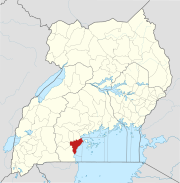 | |
| Geography |
| |
| Economy | ||
| Health | ||
| Transport | ||
| Energy | ||
| Notable landmarks | ||
| Education | ||
| Notable people | ||
Capital: Kalungu | ||
| Towns and villages |
|  |
| Geography | ||
| Transport | ||
| Health | ||
| Education |
| |
| Notable people | ||
Capital: Bukomansimbi | ||
| Towns and villages |
|  |
| Economy |
| |
| Health |
| |
| Transport | ||
| Notable people |
| |
Capital: Sembabule | ||
| Counties and sub-counties |  | |
| Towns and villages | ||
| Notable landmarks | ||
| Transport |
| |
| Notable people | ||

- Roads in Uganda
- Masaka District
- Bukomansimbi District
- Sembabule District
- Central Region, Uganda