Mason Neck State Park
| Mason Neck State Park | |
|---|---|
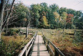 Boardwalk in Mason Neck State Park | |
 Location of Mason Neck State Park | |
| Location | 7301 High Point Rd. |
| Nearest city | Lorton, Virginia |
| Coordinates | 38°39′16″N 77°11′3″W / 38.65444°N 77.18417°WCoordinates: 38°39′16″N 77°11′3″W / 38.65444°N 77.18417°W |
| Area | 1,814 acres (7.34 km2) |
| Established | 1985 |
| Governing body | Virginia Department of Conservation and Recreation |


Mason Neck State Park is located in Fairfax County, Virginia. The park is on a peninsula formed by Pohick Bay on the north, Belmont Bay on the south and the Potomac River to the east. The park has an area of 1,814 acres (7.34 km2) and is home to bald eagles, great blue herons, ospreys, and many other types of wildlife. The park also contains white-tailed deer and many species of lichen.
Mason Neck State Park is one of the best locations to view bald eagles in northern Virginia. Sightings are most common in the mornings and evenings.
The park is day-use only, and maintains a visitors center that is open from 10 a.m. to 6 p.m.
Mason Neck State Park has cultural significance with two sites on the state and National Register of Historic Places and approximately thirty other identified archaeological sites. The Taft archaeological site was listed in 2004 and the Lexington site was listed in 2013.[1][2]
References[]
- ^ Virginia Department of Conservation and Recreation (June 15, 2010). "Mason Neck State Park: Master Plan Executive Summary, 2010 Update" (PDF). Virginia Department of Conservation and Recreation. Archived from the original (PDF) on May 8, 2013. Retrieved February 9, 2014.
- ^ "National Register of Historic Places Listings". Weekly List of Actions Taken on Properties: 5/28/13 through 5/31/13. National Park Service. 2013-06-07.
External links[]
- Virginia Department of Conservation and Recreation: Mason Neck State Park
 Media related to Mason Neck State Park at Wikimedia Commons
- State parks of Virginia
- Parks in Fairfax County, Virginia
- Protected areas established in 1985
- Protected areas of Fairfax County, Virginia