Mastwijk
This article relies largely or entirely on a single source. (November 2010) |
Mastwijk | |
|---|---|
Village | |
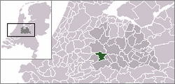 | |
 The village (dark red) and the statistical district (light green) of Mastwijk in the municipality of Montfoort. | |
| Coordinates: 52°3′N 4°58′E / 52.050°N 4.967°ECoordinates: 52°3′N 4°58′E / 52.050°N 4.967°E | |
| Country | Netherlands |
| Province | Utrecht (province) |
| Municipality | Montfoort |
| Population (1 January 2005) | |
| • Total | 430 |
| Time zone | UTC+1 (CET) |
| • Summer (DST) | UTC+2 (CEST) |

Mastwijk is a village in the Dutch province of Utrecht. It is a part of the municipality of Montfoort, and lies about 6 km southeast of Woerden.
The statistical area "Mastwijk", which also can include the surrounding countryside, has a population of around 430.[1]
References[]
- ^ Statistics Netherlands (CBS), Statline: Kerncijfers wijken en buurten 2003–2005. As of 1 January 2005.
This Utrecht location article is a stub. You can help Wikipedia by . |
Categories:
- Populated places in Utrecht (province)
- Montfoort
- Utrecht (province) geography stubs