Matatā
Matatā | |
|---|---|
Town | |
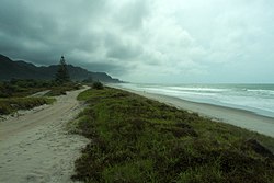 Matatā beach | |
 | |
| Coordinates: 37°53′S 176°45′E / 37.883°S 176.750°E | |
| Country | |
| Region | Bay of Plenty |
| Territorial authority | Whakatāne District |
| Ward | Rangitāiki |
| Population (2018) | |
| • Total | 681 |
| Postcode(s) | 3194[1] |

Matatā is a town in the Bay of Plenty in the North Island of New Zealand, 24 kilometres (15 mi) to the north-west of Whakatāne.
History and culture[]
Recent history[]
In 2005 the town was inundated by two debris flows from the Awatarariki and Waitepuru Streams that devastated a number of buildings, but did not cause any casualties. The debris flows were caused by a band of intense rain, at a rate of over 2 mm per minute, that fell into the catchments southwest of Matatā, dislodging a huge amount of debris that had built up behind a temporary dam.[2]
From January 2005 the area was subject to hundreds of shallow, low intensity earthquakes, with the most intense swarms occurring in 2005 and 2007, but continuing to at least February 2009. The largest event was of magnitude 4.2 in May 2007.[3][4]
In 2016, scientists discovered a large amount of volcanic activity, including "an inflating magma" buildup, 10 kilometres (6.2 mi) below the surface of the town.[5]
In 2019, the name of the town was officially gazetted as "Matatā".[6]
Marae[]
- Iramoko Marae and Te Paetata meeting house, affiliated with the Ngāti Awa hapū of Te Tāwera.
- Ngāti Umutahi Marae and Umutahi meeting house, affiliated with the Ngāti Tūwharetoa hapū of Ngāti Iramoko, Ngāti Umutahi and Te Tāwera.
- Ōniao Marae Tūwharetoa meeting house, affiliated with the Ngāti Tūwharetoa hapū of Ngāi Tamarangi, Ngāti Umutahi and Ngāti Manuwhare.
- Rangitihi Marae and Rangiaohia meeting house is affiliated with Ngāti Rangitihi.
In October 2020, the Government committed $1,646,820 from the Provincial Growth Fund to upgrade Rangitihi Marae and five other local marae, creating 10 jobs.[9]
Demographics[]
The population of Matatā town was 681 in the 2018 census, an increase of 36 from 2013. There were 336 males and 345 females. 61.7% of people identified as European/Pākehā and 56.4% as Māori.[10]
| Year | Pop. | ±% p.a. |
|---|---|---|
| 2006 | 1,608 | — |
| 2013 | 1,671 | +0.55% |
| 2018 | 1,737 | +0.78% |
| Source: [11] | ||
The statistical area of Matatā-Otakiri, which is 87 square kilometres and also includes Otakiri, had a population of 1,737 at the 2018 New Zealand census, an increase of 66 people (3.9%) since the 2013 census, and an increase of 129 people (8.0%) since the 2006 census. There were 618 households. There were 861 males and 876 females, giving a sex ratio of 0.98 males per female. The median age was 41.3 years (compared with 37.4 years nationally), with 378 people (21.8%) aged under 15 years, 279 (16.1%) aged 15 to 29, 801 (46.1%) aged 30 to 64, and 279 (16.1%) aged 65 or older.
Ethnicities were 74.8% European/Pākehā, 35.4% Māori, 1.7% Pacific peoples, 4.0% Asian, and 1.4% other ethnicities (totals add to more than 100% since people could identify with multiple ethnicities).
The proportion of people born overseas was 11.4%, compared with 27.1% nationally.
Although some people objected to giving their religion, 53.7% had no religion, 34.4% were Christian, 0.2% were Hindu, 0.2% were Muslim, 0.2% were Buddhist and 4.0% had other religions.
Of those at least 15 years old, 174 (12.8%) people had a bachelor or higher degree, and 291 (21.4%) people had no formal qualifications. The median income was $31,100, compared with $31,800 nationally. The employment status of those at least 15 was that 666 (49.0%) people were employed full-time, 234 (17.2%) were part-time, and 60 (4.4%) were unemployed.[11]
Education[]
Matata School is a decile 5 state primary school with a roll of 84 students.[12] St Joseph's Catholic School is a decile 2 integrated primary school with a roll of 33 students.[13] Both schools are coeducational and cater for years 1–8. Rolls are as of March 2021.[14]
References[]
- ^ "worldpostalcodes". Retrieved 28 April 2020.
- ^ McSaveney, M J (July 2005). The 18 May 2005 debris flow disaster at Matata: Causes and mitigation suggestions (PDF). Wellington: GeoNet.
mcsaveney
- ^ article: Jun 15 2005 – Earthquakes Near Matata Archived 16 October 2008 at the Wayback Machine
- ^ article: May 11 2007 – Renewed Earthquake Activity Near Matata Archived 16 October 2008 at the Wayback Machine
- ^ "Scientists discover magma buildup under New Zealand town". phys.org. Retrieved 4 June 2016.
- ^ "Place name detail: Matatā". New Zealand Gazetteer. New Zealand Geographic Board. Retrieved 2 August 2019.
- ^ "Te Kāhui Māngai directory". tkm.govt.nz. Te Puni Kōkiri.
- ^ "Māori Maps". maorimaps.com. Te Potiki National Trust.
- ^ "Marae Announcements" (Excel). growregions.govt.nz. Provincial Growth Fund. 9 October 2020.
- ^ "Age and sex by ethnic group (grouped total response), for census usually resident population counts, 2006, 2013, and 2018 Censuses (urban rural areas)". Statistics New Zealand. Retrieved 13 December 2020.
- ^ Jump up to: a b "Statistical area 1 dataset for 2018 Census". Statistics New Zealand. March 2020. Matatā-Otakiri (202000). 2018 Census place summary: Matatā-Otakiri
- ^ Education Counts: Matata School
- ^ Education Counts: St Joseph's Catholic School
- ^ "New Zealand Schools Directory". New Zealand Ministry of Education. Retrieved 27 April 2021.
External links[]
| hide Authority control | |
|---|---|
| General | |
| National libraries | |
- Whakatane District
- Populated places in the Bay of Plenty Region