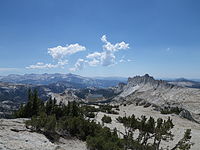
Matthes Crest
| Matthes Crest | |
|---|---|
 Matthes crest from the west side. | |
| Highest point | |
| Elevation | 10,923 ft (3,329 m) NAVD 88[1] |
| Prominence | 278 ft (85 m)[1] |
| Parent peak | Echo Ridge |
| Coordinates | 37°49′24″N 119°23′51″W / 37.823259°N 119.3973791°WCoordinates: 37°49′24″N 119°23′51″W / 37.823259°N 119.3973791°W[2] |
| Geography | |
| Location | |
| Parent range | Cathedral Range, Sierra Nevada |
| Topo map | USGS Tenaya Lake |
| Geology | |
| Age of rock | Cretaceous |
| Mountain type | Granite arête |
| Climbing | |
| First ascent | 1931 by Jules Eichorn, Glen Dawson and Walter Brem[3] |
| Easiest route | Rock climb class 5.7[4] |
Matthes Crest is an approximately mile-long fin of rock with two summits separated by a deep notch. It is a part of the Cathedral Range, which is a mountain range in the south-central portion of Yosemite National Park. The range is part of the Sierra Nevada.
History and geology[]
Matthes crest is named for François E. Matthes, a cartographer and author who described the geology in the region where Matthes Crest lies. It was originally named Echo Ridge due to its proximity to the Echo Peaks.[5] Matthes crest arose as a nunatak in the glacial field which covered Tuolumne during the last ice age.[6]
Climbing[]
The first known ascent of Matthes Crest was by Jules Eichorn, Glen Dawson, and Walter Brem on June 16, 1931.[3] Climbing Matthes Crest by traversing the ridge from south to north is a popular alpine climbing activity today.[7]

Matthes Crest from the west side

Matthes Crest from the north east side
See also[]
- Budd Lake, a lake which is near Matthes Crest
- Cathedral Peak, a mountain fairly near Matthes Crest
- Cockscomb, another mountain fairly near Matthes Crest
- Elizabeth Lake, also fairly near
References[]
- ^ Jump up to: a b "Matthes Crest, California". Peakbagger.com. Retrieved December 29, 2014.
- ^ "Matthes Crest". Geographic Names Information System. United States Geological Survey. Retrieved December 29, 2014.
- ^ Jump up to: a b Roper, Steve (1976). The Climber's Guide to the High Sierra. San Francisco: Sierra Club Books. p. 335. ISBN 9780871561473.
- ^ Barnes, G. and McNamara, C. and Roper, S. (2009). Tuolumne Free Climbs. SuperTopo. ISBN 9780976523574.CS1 maint: multiple names: authors list (link)
- ^ Farquhar, Francis P. (1926). Place Names of the High Sierra. San Francisco: Sierra Club.
- ^ Matthes, Francois (1950). The Incomparable Valley, A Geological Interpretation of the Yosemite. The University of California Press.
- ^ "Matthes Crest". SummitPost.org. Retrieved May 25, 2014.
External links[]
- Matthes Crest Traverse - South to North. Mountain Project.
- Geology of Yosemite National Park
- Mountains of Yosemite National Park
- Mountains of Mariposa County, California
- Mountains of Tuolumne County, California
- Mountains of Northern California


