Mavli tehsil
Mavli tehsil | |
|---|---|
Tehsil | |
 Mavli tehsil | |
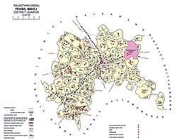
 Mavli tehsil Location of Mavli tehsil | |
| Coordinates: 24°47′30″N 73°58′57″E / 24.791727°N 73.982498°ECoordinates: 24°47′30″N 73°58′57″E / 24.791727°N 73.982498°E | |
| Tehsil seat | Mavli |
| Area | |
| • Total | 837 km2 (323 sq mi) |
| [2] | |
| Population (2011) | |
| • Total | 230,532[1] |
| Time zone | Indian Standard Time |


Mavli is a tehsil of Udaipur district in Rajasthan, India.The tehsil consists of 179 revenue villages which are organized in 42 gram panchayats and one town (Mavli).[2] The tehsil headquarter is located in the town of Mavli.[2] The boundaries of Mavli tehsil are conterminous with those of Mavli panchayat samiti.[2]
History[]
Before the formation of the Republic of India, the territory of present-day Mavli tehsil was part of the former Udaipur State.[1] With the formation of the United State of Rajasthan (precursor to the state of Rajasthan) in 1948, the new district of Udaipur was constituted which included Mavli tehsil.[1]
Geography[]
The area of Mavli tehsil is 837 square kilometres.[2] The tehsil is bordered by Girwa tehsil to the west, Rajsamand district to the north, Chittaurgarh district to the east, and Vallabhnagar tehsil to the south.[2] The annual average rainfall in Mavli tehsil is 604 mm, with an average of 30 rainy days per year.[3]
22 villages of Mavli that are in the vicinity of the city of the Udaipur urban area are subject to the jurisdiction urban planning policies of the Udaipur Urban Improvement Trust.[4][5]
Demographics[]
The population of Mavli tehsil is 230,532, of which 96% is classified as rural in the 2011 census.[2] The sex ratio in the tehsil is 967.[2] The tehsil's literacy rate is 52%.[2]Mewari is the predominant language used in the tehsil, being the first language for 98% of the population of the tehsil.[6]
Economy[]
Agriculture is a significant sources of income in Mavli tehsil with 57% of workers identifying as cultivators or agricultural labourers in the 2011 census.[1]
References[]
- ^ a b c d District Census Handbook Udaipur, Village and Town Wise Primary Census Abstract (PDF). Directorate of Census Operations. 2011.
- ^ a b c d e f g h i District Census Handbook Udaipur, Village and Town Directory (PDF). Directorate of Census Operations. 2011.
- ^ Singh, O.P.; et al. (2013). Rainfall Profile of Udaipur (PDF). Meteorological Monograph: Hydrology No.15/2013. New Delhi: India Meteorological Department. p. 108.
- ^ Udaipur ke adhighoshit nagriya kshetra mein sthit gram panchayat evam panchayat samiti ki suchi yathavidyaman mah agast 2016 (PDF). City Development Office Udaipur. 2016. Retrieved 19 April 2019.
- ^ Udaipur Urban Area Map 2031. Government of Rajasthan. 2013. Retrieved 19 April 2019.
- ^ "C-16 Population By Mother Tongue". Census of India. Retrieved 5 September 2018.
- Tehsils of Rajasthan
- Tehsils of Udaipur district