Mavulis Island
Native name: Y'Ami Amianan | |
|---|---|
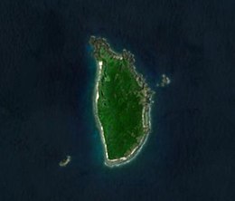 Satellite image of the island | |
 Mavulis Island Location within the northern extremity of the Philippines | |
| Geography | |
| Location | Luzon Strait |
| Coordinates | 21°6′47″N 121°57′6″E / 21.11306°N 121.95167°ECoordinates: 21°6′47″N 121°57′6″E / 21.11306°N 121.95167°E |
| Archipelago | Batanes Group of Islands |
| Administration | |
| Region | Cagayan Valley |
| Province | Batanes |
| Municipality | Itbayat |
| Demographics | |
| Population | uninhabited |

Mavulis Island is the northernmost of the Batanes Islands and the northernmost island in the Philippines. It is part of the province of Batanes. The island is uninhabited but it is guarded by the military. It is also frequently visited by local fishermen (mostly from Itbayat and Basco) for fishing adventures.
The island has a newly constructed military and fishermen shelter, a water desalination plant, a helipad, lighthouse, and a flagpole on the top of the hill in the island.[1][2][3]
The island also hosts the northernmost flagpole in the country.[3]
Alternative names[]
Older Batan natives also called the island Dimavulis or Dihami, meaning "north" in Ivatan. By some members of the Spanish colonial government it was called Diami, and it is known as Yami or Y'Ami on most American Colonial Era maps of the Philippines. The latter should not be confused with the aboriginal Yami of Taiwan that live on islands farther north beyond Philippine territorial limits, but are geographically, culturally and linguistically related to the Ivatan people. The island is also called Amianan, meaning "north" in Ilocano.
Geography[]

The island is part of the Luzon Volcanic Arc, and is located 141 kilometers (88 mi) southeast of the southern tip of Taiwan's main island and 98 km to the nearest Taiwanese island, the "Lesser Orchid Island". The distance to Luzon is 288 kilometers (179 mi). The island is 2.2 km long and up to a kilometer wide. The highest point, Y'Ami Hill, is 219 meters (719 ft) high. The island is rocky on the coasts but covered in lush vegetation, including mangrove, vuyavuy palms and other native shrubs. Coconut crabs are found on the island in large numbers.
Development[]
The Armed Forces of the Philippines Northern Luzon Command in 2016 has pushed for the establishment of a Marine detachment on Mavulis Island to affirm the Philippines' sovereignty on the northernmost point of the archipelago. The Marine detachment was opened in 2018, with a fisherman's shelter completed in 2019 and turned over to the local municipality for maintenance and operation.[4][5]
In May 2021, the Department of Defense of the Philippines announced the electrification of the island through a solar power station, with a back-up diesel generator. This was done through the help of the One Meralco Foundation. The DND also announced the commissioning of a desalination plant to provide potable water to personnel assigned to the island.[6]
Gallery[]

Aerial view of the island, 1935

Sec. Delfin Lorenzana leads a toast of the water produced by the desalination plant at Mavulis Island.

See also[]
- Extreme points of the Philippines
- Desert island
- List of islands
References[]
- ^ Mangosing, Frances (28 May 2019). "Multi-purpose shelter for fishers, troops unveiled in northernmost PH isle". Philippine Daily Inquirer. Retrieved 28 May 2019.
- ^ Dumlao, Artemio (26 April 2019). "Fishermen's shelter completed on Batanes island". The Philippine Star. Retrieved 28 May 2019.
- ^ a b Baccay, Oliver T. "Raise your flag". pia.gov.ph. Philippine Information Agency. Retrieved 13 May 2020.
- ^ Alindogan, Jamela. "Why Philippines is building military base near Taiwan". Al-Jazeera. Al-Jazeera. Retrieved 28 May 2021.
- ^ Martin, Victor (29 May 2019). "Philippines establishes fishermen's shelter in Batanes". Philstar.com. Philippine Star. Retrieved 28 May 2021.
- ^ "Desalination plant installed in PH's northernmost outpost". Department of Defense. Department of Defense of the Philippines. Retrieved 28 May 2021.
This article about a location in Cagayan Valley region is a stub. You can help Wikipedia by . |
- Islands of Batanes
- Uninhabited islands of the Philippines
- Philippines geography stubs