Maypole Airfield
Maypole Airfield | |||||||||||
|---|---|---|---|---|---|---|---|---|---|---|---|
| Summary | |||||||||||
| Location | Hoath, Kent | ||||||||||
| Elevation AMSL | 125 ft / 38 m | ||||||||||
| Coordinates | 51°20′18″N 1°09′25″E / 51.33833°N 1.15694°ECoordinates: 51°20′18″N 1°09′25″E / 51.33833°N 1.15694°E | ||||||||||
| Website | www | ||||||||||
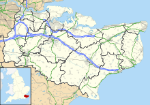
| Map | |||||||||||
 Maypole Airfield Location in England | |||||||||||
| Runways | |||||||||||
| |||||||||||

Maypole Airfield (ICAO: EGHB) was a general aviation airfield located 2.5 miles (4.0 km) south of Herne Bay, Kent and 5.2 miles (8.4 km) north east of Canterbury, Kent, United Kingdom. It was scheduled to close in January 2021,[1] and is closed as of May 2021.
Accidents and incidents[]
- During October 2012 a small plane overshot the runway and crashed with no injuries.[2]
See also[]
References[]
- ^ https://www.flyer.co.uk/maypole-airfield-to-close-in-january/. Retrieved 8 May 2021. Missing or empty
|title=(help) - ^ "Woman escapes plane after overshooting runway at Hoath's Maypole Airfield". KentOnline. Retrieved 28 May 2014.
External links[]
Categories:
- Airports in Kent