Mefalsim
Mefalsim
מפלסים مفلاسيم | |
|---|---|
 | |
 Mefalsim | |
| Coordinates: 31°30′7″N 34°33′52″E / 31.50194°N 34.56444°ECoordinates: 31°30′7″N 34°33′52″E / 31.50194°N 34.56444°E | |
| Country | |
| District | Southern |
| Council | Sha'ar HaNegev |
| Affiliation | Kibbutz Movement |
| Founded | 1949 |
| Founded by | Argentine and Uruguayan Jews |
| Population (2019)[1] | 1,024 |
| Website | www |


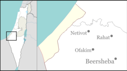
Mefalsim (Hebrew: מְפַלְּסִים, lit. Road pavers) is a kibbutz in southern Israel. Located near the Gaza Strip and covering 11,000 dunams, it falls under the jurisdiction of Sha'ar HaNegev Regional Council. In 2019 it had a population of 1,024.[1]
History[]
The village was established in 1949 by members of the MAMLT youth movement, most of whom were immigrants from Argentina and Uruguay.[2] It was named for the immigrants from Latin America who paved the way for others to make aliyah.[2]
After the Israeli disengagement from Gaza in 2005, the kibbutz absorbed some of the evicted families.[3] Since 2001, the kibbutz has been hit by dozens of rockets launched from the Gaza Strip, with a few buildings destroyed, including the kindergarten in 2012.[4] In 2018, the village was the first location set ablaze by a fire balloon.[5]
References[]
- ^ a b "Population in the Localities 2019" (XLS). Israel Central Bureau of Statistics. Retrieved 16 August 2020.
- ^ a b Mefalsim, Shaar Hanegev Negev Information Centre
- ^ Relocation housing for Gush Katif evacuees Getty Images
- ^ Ser, Sam (August 17, 2005). "Evacuees Settle in at Kibbutz Mefalsim". The Jerusalem Post. Archived from the original on October 18, 2016. Retrieved April 18, 2019.
- ^ Tzuri, Matan; Levi, Elior (May 7, 2018). נזקים כבדים בעוטף עזה בגלל בלוני תבערה [Heavy Damage in Otef Aza due to Incendiary Balloons]. Yedioth Ahronoth (in Hebrew). Retrieved April 18, 2019.
External links[]
- Kibbutz website (in Hebrew)
- Living under the volcano of Gaza Euronews, 23 November 2012
- Sha'ar HaNegev Regional Council
- Argentine-Jewish culture in Israel
- Uruguayan diaspora in Israel
- Kibbutzim
- Kibbutz Movement
- Populated places established in 1949
- Gaza envelope
- Populated places in Southern District (Israel)
- South American-Jewish culture in Israel
- 1949 establishments in Israel