Meir premetro station
Meir | ||||||||||||||||||||||||||
|---|---|---|---|---|---|---|---|---|---|---|---|---|---|---|---|---|---|---|---|---|---|---|---|---|---|---|
 | ||||||||||||||||||||||||||
| Location | Belgium | |||||||||||||||||||||||||
| Coordinates | 51°13′06.114″N 04°24′20.874″E / 51.21836500°N 4.40579833°E | |||||||||||||||||||||||||
| Operated by | De Lijn | |||||||||||||||||||||||||
| Construction | ||||||||||||||||||||||||||
| Structure type | underground | |||||||||||||||||||||||||
| Platform levels | 2 | |||||||||||||||||||||||||
| History | ||||||||||||||||||||||||||
| Opened | 25 March 1975 | |||||||||||||||||||||||||
| Services | ||||||||||||||||||||||||||
| ||||||||||||||||||||||||||
| Location | ||||||||||||||||||||||||||
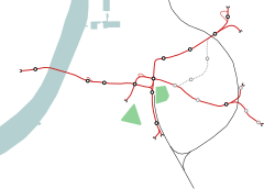 Meir Location within the Antwerp premetro network | ||||||||||||||||||||||||||

Meir is a station in the Antwerp premetro which opened on 23 March 1975. The station is located directly underneath the street Meir, after which it is named.
With Groenplaats and Opera, Meir forms the oldest part of the city's premetro network. It is served by tramlines 3, 5, 9 and .[1] passes in close proximity at street level.[2]
Location[]
The station is located in central Antwerp at the western end of the Meir street. In its immediate vicinity is the Boerentoren, a 1930s art deco building which at the time of its construction was Europe's first skyscraper.[3]
References[]
- ^ "Halte Antwerpen Premetrostation Meir". https://www.delijn.be/nl/haltes/halte/104720/Antwerpen_Premetrostation_Meir.
{{cite web}}: External link in|location=|url=(help)CS1 maint: location (link) - ^ "Tramschema Antwerpen". https://static.delijn.be/Images/Flanders%20Tramschema_tcm3-5304.pdf.
{{cite web}}: External link in|location=|url=(help)CS1 maint: location (link) - ^ "Boerentoren, Inventaris Onroerend Erfgoed [online]". Agentschap Onroerend Erfgoed. Retrieved 11 August 2016.
Categories:
- Antwerp Premetro
- Railway stations opened in 1975
- 1975 establishments in Belgium