Mexican Federal Highway
This article needs additional citations for verification. (January 2018) |
| Federal Highways | |
|---|---|
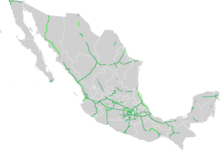
     One-, two-, three-digit, and letter designation shields and tollway shield | |
 | |
| System information | |
| Maintained by Secretariat of Communications and Transportation | |
| Highway names | |
| Federal Highway: | Federal Highway X (Fed. X) |
| System links | |
| Mexican Federal Highways List • Autopistas | |
Federal Highways (Spanish: Carretera Federal), are a series of highways that connect with roads from foreign countries; link two or more states of the Federation; and are wholly or mostly built by the Federation with federal funds or through federal grants by individuals, states, or municipalities.[1] Locally known as federal highway corridors (Spanish: los corredores carreteros federales), built and maintained by the federal government of Mexico via the Secretariat of Communications and Transportation (Spanish: Secretaría de Comunicaciones y Transportes, SCT). Federal Highways in Mexico can be classified into high-speed roads with restricted access (usually toll highways that may be segmented, and are marked by the letter "D") and low-speed roads with non-restricted access; not all corridors are completely improved.
High speed with restricted-access roads[]
Restricted-access roads, known as Autopistas or Supercarreteras, are limited-access expressways with controlled points of access interchanges. Access to these roads is generally prohibited for pedestrians and animal-drawn vehicles, as fences are located at the side of the road for most of the length. Autopistas are highways with four or more defined lanes. Supercarreteras are always two-lane highways and are most commonly found in mountainous areas. The maximum speed limit is normally 110 km/h (68 mph) for cars and 95 km/h (59 mph) for buses and trucks. In some cases, the maximum speed can be 120 km/h (75 mph).[2]
Low speed with non-restricted-access roads[]
Low-speed/non-restricted-access roads, known as Autopistas or Carreteras, comprise the majority of the road corridors. Autopistas are divided highways with four or more lanes. Most of these autopistas are single-carriageway roads converted into dual carriageway by building an adjacent road body next to the existing one. Carretera are free, and in most cases, two-lane highways that connect almost all of Mexico. These roads have interchanges at major roads, but most intersections are at grade. The maximum speed limit is 100 km/h (62 mph) for cars and 95 km/h (59 mph) for buses and trucks.[2]
Numbering system[]
North–south highways are assigned odd numbers, while east-west highways are identified by even numbers. The start of the numbering system is located in the northwest of the country.
Exceptions to the numbering system[]
There are two exceptions to the numbering system:[citation needed]
- Federal Highway 14 (Fed. 14) and Federal Highway 14D (Fed. 14D) from Uruapan, Michoacán, to Morelia, Michoacán, located in the midwest of the country.
- Several roads with letter designations: the Autopista Arco Norte (M40D), Fed. I-20D (Libramiento de Irapuato), Fed. S30 (Libramiento Norponiente de Saltillo, signed as 40D) and, Fed. GUA 10D (Macrolibramiento Sur De Guadalajara).
See also[]
References[]
- ^ Gutiérrez, Norma (March 2014). "National Funding of Road Infrastructure: Mexico". www.loc.gov. Retrieved 21 February 2020.
- ^ Jump up to: a b "Driving in Mexico | Tips | Mexpro". www.mexpro.com. Retrieved 2018-01-12.
External links[]
- Mexican Federal Highways
- Roads in Mexico