Microregion of Bananal
- See Bananal for namesakes
Microregion of Bananal | |
|---|---|
Microregion | |
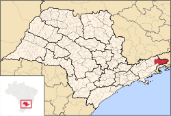 Location of Microregion of Bananal in the state of São Paulo | |
| Country | |
| Region | Southeast |
| State | |
| Mesoregion | |
| Time zone | UTC-3 (UTC-3) |
| • Summer (DST) | UTC-2 (UTC-2) |
The Microregion of Bananal (Portuguese: Microrregião de Bananal) is a microregion in the east of São Paulo State, Brazil.
It is the easternmost microregion of the state, bordered by the state of Rio de Janeiro to the east.
Municipalities[]
The microregion consists of the following municipalities:[1]
References[]
- ^ Instituto Brasileiro de Geografia e Estatística[permanent dead link], territorial division.
See also[]
- Bananal Island
- the former Catholic Territorial Prelature of Bananal
Coordinates: 22°41′02″S 44°19′22″W / 22.68389°S 44.32278°W

This geographical article relating to the state of São Paulo is a stub. You can help Wikipedia by . |
Categories:
- Microregions of São Paulo (state)
- São Paulo (state) geography stubs