Milford, Delaware
Milford, Delaware | |
|---|---|
City | |
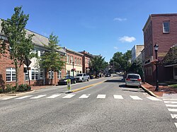 Walnut Street in Milford in 2020 | |
 Location of Milford in Kent County and Sussex County, Delaware. | |
 Milford Location within the state of Delaware | |
| Coordinates: 38°54′45″N 75°25′41″W / 38.91250°N 75.42806°WCoordinates: 38°54′45″N 75°25′41″W / 38.91250°N 75.42806°W | |
| Country | |
| State | |
| County | |
| Settled | 1680 |
| Incorporated | February 5, 1807 |
| Government | |
| • Type | Council-manager government |
| • Mayor | Archie Campbell |
| • City Manager | Mark Whitfield |
| Area | |
| • Total | 9.86 sq mi (25.54 km2) |
| • Land | 9.77 sq mi (25.31 km2) |
| • Water | 0.09 sq mi (0.23 km2) |
| Elevation | 13 ft (4 m) |
| Population (2010) | |
| • Total | 9,559 |
| • Estimate (2019)[3] | 11,732 |
| • Density | 1,200.33/sq mi (463.45/km2) |
| Time zone | UTC−5 (Eastern (EST)) |
| • Summer (DST) | UTC−4 (EDT) |
| ZIP code | 19963 |
| Area code(s) | 302 |
| FIPS code | 10-47420 |
| GNIS feature ID | 214308[2] |
| Website | www.cityofmilford.com |


Milford is a city in Kent and Sussex counties in the U.S. state of Delaware. According to the 2010 census, the population of the city is 9,559 people and there are 4,126 households in the city.[4]
The Kent County portion of Milford is part of the Dover, DE Metropolitan Statistical Area and the Philadelphia-Reading-Camden, PA-NJ-DE-MD Combined Statistical Area,[5] while the Sussex County portion is part of the Salisbury, MD-DE Metropolitan Statistical Area.
Geography and climate[]
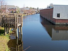
Milford is located at 38°54′45″N 75°25′41″W / 38.91250°N 75.42806°W (38.9126129, −75.4279748),[6] along the Mispillion River, which runs through the city.[7]
According to the United States Census Bureau, the city has a total area of 9.87 square miles (25.6 km2).

| hideClimate data for Milford, Delaware | |||||||||||||
|---|---|---|---|---|---|---|---|---|---|---|---|---|---|
| Month | Jan | Feb | Mar | Apr | May | Jun | Jul | Aug | Sep | Oct | Nov | Dec | Year |
| Record high °F (°C) | 79 (26) |
78 (26) |
90 (32) |
97 (36) |
99 (37) |
102 (39) |
106 (41) |
103 (39) |
99 (37) |
95 (35) |
86 (30) |
76 (24) |
106 (41) |
| Average high °F (°C) | 43 (6) |
45 (7) |
54 (12) |
64 (18) |
73 (23) |
82 (28) |
87 (31) |
85 (29) |
78 (26) |
68 (20) |
58 (14) |
48 (9) |
65 (19) |
| Average low °F (°C) | 24 (−4) |
25 (−4) |
33 (1) |
42 (6) |
52 (11) |
62 (17) |
67 (19) |
65 (18) |
57 (14) |
46 (8) |
36 (2) |
29 (−2) |
45 (7) |
| Record low °F (°C) | −11 (−24) |
−11 (−24) |
4 (−16) |
16 (−9) |
28 (−2) |
36 (2) |
39 (4) |
43 (6) |
34 (1) |
19 (−7) |
9 (−13) |
−2 (−19) |
−11 (−24) |
| Average precipitation inches (mm) | 4.08 (104) |
3.30 (84) |
4.51 (115) |
3.50 (89) |
4.03 (102) |
3.31 (84) |
3.69 (94) |
4.61 (117) |
4.08 (104) |
3.48 (88) |
3.32 (84) |
3.59 (91) |
45.50 (1,156) |
| Average snowfall inches (cm) | 3.9 (9.9) |
5.4 (14) |
0.9 (2.3) |
0.1 (0.25) |
0 (0) |
0 (0) |
0 (0) |
0 (0) |
0 (0) |
0 (0) |
0.2 (0.51) |
1.5 (3.8) |
12 (30.76) |
| Source: [8] | |||||||||||||
History[]
The Kent County side of Milford was first settled in 1680 by Henry Bowan on what was known as the Saw Mill Range. A century later the Reverend Sydenham Thorne built a dam across the Mispillion River to generate power for his gristmill and sawmill. Around the same time, Joseph Oliver laid out the first city streets and plots nearby on a part of his plantation. Soon a number of homes and businesses appeared along Front Street. The city was incorporated February 5, 1807.[9]
In the 1770s, a ship building industry was already flourishing on the Mispillion River. Shipbuilding continued to be the major industry of Milford through World War I, bringing considerable prosperity to the town. The high point came in 1917 when the four-masted, 174-foot (53 m) long Albert F. Paul was launched from the William G. Abbott shipyard. At one point six shipyards were operating in the downtown area. When the last of the area's giant white oaks was cut in the 1920s, the shipyards quickly went out of business, although the Mispillion ships sailed on for many years. (The Paul was sunk by a German torpedo in 1942 while sailing from the Bahamas.) The Vineyard shipyard was called into service in both World War I and II to build submarine chasers.[9]
During much of the twentieth century Milford served primarily as the commercial center for much of southern Delaware's large agricultural community.[9]
Seven of Delaware's governors have come from Milford: Daniel Rogers (who served 1797–99), Joseph Haslet (1811–14), William Tharp (1847–1851), Peter F. Causey (1855–59), William Burton (1859–63), William T. Watson (1895–97), and Ruth Ann Minner (2001–09).[9]
Abbott's Mill, Bank House, Carlisle House, Christ Church, Dr. Dawson House, Draper House, Egglinton Hall, Golden Mine, Grier House, Peter Lofland House, James McColley House, Milford New Century Club, Milford Railroad Station, Milford Shipyard Area Historic District, Mill House, Mispillion Lighthouse and Beacon Tower, North Milford Historic District, Old Fire House, Parson Thorne Mansion, South Milford Historic District Walnut Farm, Gov. William T. Watson Mansion, and J. H. Wilkerson & Son Brickworks are listed on the National Register of Historic Places.[10]
On Friday, May 30, 2003 at approximately 3:00 p.m. a fire started in a second floor apartment next to Wiley Hardware & Appliance on Walnut Street in the historic downtown section of Milford. More than 200 firefighters from Milford, Ellendale, Harrington, Felton, Dover, Smyrna, Houston, Frederica, Slaughter Beach, Bowers Beach, Greenwood, South Bowers, Farmington, Magnolia, Cheswold, Lewes, Georgetown, and Bridgeville in Delaware and Greensboro and Goldsboro in Maryland fought the blaze which destroyed seven businesses, a church, and three apartments, destroying an entire city block in the historic section of town. No one was killed in the blaze, but one civilian and six firefighters were injured.[11]
Demographics[]
| Historical population | |||
|---|---|---|---|
| Census | Pop. | %± | |
| 1860 | 1,178 | — | |
| 1870 | 1,150 | −2.4% | |
| 1880 | 1,240 | 7.8% | |
| 1890 | 2,555 | 106.0% | |
| 1900 | 2,500 | −2.2% | |
| 1910 | 2,603 | 4.1% | |
| 1920 | 2,703 | 3.8% | |
| 1930 | 3,719 | 37.6% | |
| 1940 | 4,214 | 13.3% | |
| 1950 | 5,179 | 22.9% | |
| 1960 | 5,795 | 11.9% | |
| 1970 | 5,314 | −8.3% | |
| 1980 | 5,366 | 1.0% | |
| 1990 | 6,040 | 12.6% | |
| 2000 | 6,732 | 11.5% | |
| 2010 | 9,559 | 42.0% | |
| 2019 (est.) | 11,732 | [3] | 22.7% |
As of the census[13] of 2010, there were 9,559 people, 4,126 housing units and 2,356 family households in the City. The population density was 968 people per square mile (467.5/km2). There were 4,126 housing units at an average density of 418 per square mile (201.2/km2). The racial makeup of the city was 65% White, 22.3% African American, and 12% from other races. Hispanic or Latino of any race were 15.8% of the population.
The median age within Milford is 37.9 years old. 7.8% of the population is under the age of 5, 18.9% between 5 and 19 years of age, 49.7% between 20 and 59 years of age, and 23.6% 60 years of age and older.
The median household income according to the 2010 census is $52,274, and the median family income is $59,365. 13.1% of families are below poverty level, which is slightly higher than the national average of 11.5%, and higher than the Kent County and Sussex County average of 9.7% and 9.1% respectively.
Education[]
Milford School District operates public schools.[14][15]
Infrastructure[]
Transportation[]
Milford is served by several state roads connecting it to other points in Delaware. Delaware Route 1 bypasses Milford to the east along the Milford Bypass and heads north to Dover and southeast to the Delaware Beaches. A business route of DE 1, Delaware Route 1 Business, passes through the city along Rehoboth Boulevard and North Walnut Street. U.S. Route 113 begins at DE 1 at the north end of the Milford and heads south through the city on Dupont Boulevard, continuing south to Georgetown. Delaware Route 14 runs east–west through the city on Northwest Front Street and Northeast Front Street, heading west to Harrington and east to its terminus at the DE 1 bypass. Delaware Route 36 runs east–west through the city on Lakeview Avenue, Causey Avenue, and Southeast Front Street, heading southwest to Greenwood and east to Slaughter Beach. Delaware Route 15 begins at DE 14 west of Milford and heads northwest to Canterbury. Delaware Route 30 begins at DE 1 and DE 1 Business southeast of Milford and heads south toward Milton and Millsboro.[16] DART First State provides bus service to Milford along Route 210, which runs through the city between the Bayhealth Hospital, Sussex Campus and the Walmart in the northern part of Milford; Route 303, which runs north to Dover and south to Georgetown; and Route 307, which runs north to Dover and south to Lewes.[17] The Indian River Subdivision line of the Delmarva Central Railroad passes through Milford.[18]
Utilities[]
The City of Milford Electric Department provides electricity to the city, operating a substation and over 100 miles (160 km) of overhead lines and over 50 miles (80 km) of underground lines.[19] The city's electric department is a member of the Delaware Municipal Electric Corporation (DEMEC) and purchases its power from the PJM Power Grid. The City of Milford Electric Department serves about 6,500 customers.[20] The Public Works department provides trash and recycling collection to Milford.[21][22] The Engineering department provides water and sewer service to the city. The city's water system draws from groundwater with 4 well facilities that each consist of 11 wells.[23] Natural gas service in Milford is provided by Chesapeake Utilities.[24]
Milford is home to the Milford Solar Farm, a 15 MW, 80 acre solar power farm that is owned by the Public Service Enterprise Group and is the largest solar power farm in Delaware. DEMEC purchases the power generated from the solar farm.[25]
Health care[]
Bayhealth Medical Center operates the Bayhealth Hospital, Sussex Campus in Milford.[26] The hospital offers various inpatient services include a birthing room and cardiovascular and cancer services. The Sussex Campus also offers numerous outpatient services, patient and family support services, community outreach, and imaging services. The hospital has a 24-hour emergency room with a Level III trauma center.[27][28] On May 27, 2016, Bayhealth Medical Center broke ground on the Bayhealth Sussex Campus to replace the former Milford Memorial Hospital. The six-story hospital cost between $275 million and $300 million to build.[29] Bayhealth Sussex Campus opened on February 5, 2019.[30] Milford Memorial Hospital will be converted by Nationwide Health Services into a multi-use healthcare-focused community that would include a nursing home.[31]
Notable people[]
- Mike Bagley, commentator for Motor Racing Network and co-host of The Morning Drive on Sirius XM NASCAR Radio
- Jeff Baldwin, baseball player
- Robert Crumb, a famous cartoonist, lived in Milford for a few years and attended high school there
- Albert Jackson, the first black letter carrier in Canada
- Simmie Knox began to teach himself to paint while living in Milford as a young man; he later became the first African-American to paint an official presidential portrait – that of President Bill Clinton
- John Lofland (1798–1849), widely known as the "Milford Bard", was a prolific and widely read writer of prose, verse and speeches; he grew up and spent much of his life in "The Towers" on North West Front Street
- Ruth Ann Minner, Governor of Delaware 2001–2009
- Harold Peterman, state legislator
- Luke Petitgout, former American football offensive tackle played in the National Football League for the New York Giants and Tampa Bay Buccaneers
- Chris Short, star baseball pitcher for Philadelphia Phillies in 1960s, was born in Milford
- Alfred Thomas Archimedes Torbert, Union General in the civil war and diplomat
- William T. Watson, 49th Governor of Delaware
Earl Bradley former pediatrician who was convicted on 103 counts of sexual abuse involving minors. It is generally considered the worst case of its kind in U.S. history
References[]
- ^ "2019 U.S. Gazetteer Files". United States Census Bureau. Retrieved July 2, 2020.
- ^ "Milford". Geographic Names Information System. United States Geological Survey.
- ^ Jump up to: a b "Population and Housing Unit Estimates". Retrieved May 21, 2020.
- ^ "The Delaware Census State Data Center". delaware.gov. Archived from the original on 31 December 2016. Retrieved 1 September 2015.
- ^ "Archived copy" (PDF). Office of Management and Budget. Archived (PDF) from the original on 2017-01-21. Retrieved 2013-04-02 – via National Archives.CS1 maint: archived copy as title (link)
- ^ "US Gazetteer files: 2010, 2000, and 1990". United States Census Bureau. 2011-02-12. Retrieved 2011-04-23.
- ^ DeLorme (2004). Maryland Delaware Atlas & Gazetteer. p. 52. Yarmouth, Maine: DeLorme. ISBN 0-89933-279-X.
- ^ "Milford, DE Monthly Weather Averages". Retrieved 2020-08-18.
- ^ Jump up to: a b c d "History of Milford, Delaware". cityofmilford.com. Retrieved 2012-04-11.
- ^ "National Register Information System". National Register of Historic Places. National Park Service. July 9, 2010.
- ^ "Fire Hits Block In Historic Milford, Delaware". Firehouse. Retrieved 1 September 2015.
- ^ "Census of Population and Housing". Census.gov. Retrieved June 4, 2016.
- ^ "U.S. Census website". United States Census Bureau. Retrieved 2008-01-31.
- ^ "2020 CENSUS - SCHOOL DISTRICT REFERENCE MAP: Kent County, DE" (PDF). U.S. Census Bureau. Retrieved 2021-06-16.
- ^ "2020 CENSUS - SCHOOL DISTRICT REFERENCE MAP: Sussex County, DE" (PDF). U.S. Census Bureau. Retrieved 2021-06-15.
- ^ Delaware Department of Transportation (2008). Delaware Official Transportation Map (PDF) (Map). Dover: Delaware Department of Transportation.
- ^ "Routes and Schedules". DART First State. Retrieved August 16, 2013.
- ^ "Delmarva Central Railroad". Carload Express. Retrieved March 27, 2017.
- ^ "Electric Utility Service - About Our System". City of Milford. Retrieved August 10, 2017.
- ^ "Electric Utility Service". City of Milford. Retrieved August 10, 2017.
- ^ "Trash Collection". City of Milford. Archived from the original on August 11, 2017. Retrieved August 10, 2017.
- ^ "Recycling Collection". City of Milford. Archived from the original on August 11, 2017. Retrieved August 10, 2017.
- ^ "Engineering". City of Milford. Retrieved August 10, 2017.
- ^ "Delmarva Service Territory". Chesapeake Utilities. Retrieved August 14, 2017.
- ^ "Governor Markell helps dedicate PSEG Milford Solar Farm" (Press release). Delaware Department of Natural Resources and Environmental Control. April 17, 2013. Retrieved August 14, 2017.
- ^ "Locations & Contact". Bayhealth. Retrieved February 5, 2019.
- ^ "Bayhealth Medical Center Stats & Services". U.S. News and World Report. Retrieved June 21, 2014.
- ^ "Emergency Care". Bayhealth. Retrieved February 5, 2019.
- ^ Rini, Jen (May 27, 2016). "Bayhealth breaks ground on Milford campus". The News Journal. Wilmington, DE. Retrieved August 8, 2017.
- ^ Bavaro, Angelo (February 5, 2019). "Bayhealth Hospital Sussex Campus opens". Salisbury, MD: WBOC-TV. Retrieved February 5, 2019.
- ^ "Re-imagining Clarke Avenue". Bayhealth. Retrieved August 8, 2017.[permanent dead link]
External links[]
![]() Media related to Milford, Delaware at Wikimedia Commons
Media related to Milford, Delaware at Wikimedia Commons
| show Municipalities and communities of Kent County, Delaware, United States |
|---|
| show Municipalities and communities of Sussex County, Delaware, United States |
|---|
| show |
|---|

| show Salisbury metropolitan area |
|---|
| show Authority control |
|---|
- Milford, Delaware
- Cities in Kent County, Delaware
- Cities in Sussex County, Delaware
- Populated places established in 1680
- 1680 establishments in Delaware
- Cities in Delaware
- Salisbury metropolitan area