Milford, Surrey
| Milford | |
|---|---|
 St John the Evangelist Church, Milford | |
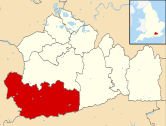
 Milford Location within Surrey | |
| Population | 4,156 (2011 Census Ward)[1] |
| OS grid reference | SU943421 |
| District |
|
| Shire county | |
| Region | |
| Country | England |
| Sovereign state | United Kingdom |
| Post town | Godalming |
| Postcode district | GU8 |
| Dialling code | 01483 |
| Police | Surrey |
| Fire | Surrey |
| Ambulance | South East Coast |
| UK Parliament | |
Milford is the civil parish and large village which is south west of Godalming in Surrey, England which was a small village in the early medieval period — it grew significantly after the building of the Portsmouth Direct Line which serves Godalming railway station and its own minor stop railway station. The village, served by a wide array of shops and amenities, has to one side an all-directions junction of the A3, one of Britain's trunk roads. Nearby settlements are Eashing, Shackleford, Witley and Elstead, and the hamlets of Enton and Hydestile, all of which are in the Borough of Waverley. The west of the parish is in the Surrey Hills AONB.
Transportation[]
Until the 1990s, the A3 road ran through the village (it now bypasses it to the west). Milford is still an important road junction, where the A283 road and A286 roads leave the A3 and run south to West Sussex. Milford railway station is on the mainline between London Waterloo and Portsmouth Harbour.
Education[]
Milford has a primary school, Milford Infant School and a secondary school, Rodborough School.
Facilities[]
The Church of England Parish Church is St. John the Evangelist, on Church Road. There is also St Joseph's Roman Catholic Church on Portsmouth Road, and Milford Baptist Church on New Road. Milford has a post office, a Chinese takeaway shop, a fish and chip shop, a shop selling art and crafts made by people in the area, called the Surrey Guild Craft shop, located at the top of Moushill lane, veterinary surgery, an off-licence, a butcher and fishmonger, two dry-cleaners, a corner shop co-op, a Tesco Express, a hairdresser, two beauticians, two doctors' surgeries, a petrol station, a swing park, a social club and a pub, The Refectory.
The village also has a cricket green and a football pitch which is home to Milford & Witley Football Club and Milford Cricket Club, who have two teams who play in the Saturday I'Anson League. Here, the Burton Pavilion also hosts dance, yoga and pilates classes. Another green in the village, the Jubilee field, is used for village fêtes and travelling funfairs & circuses. Milford also has Brownie and Guide Companies and Scouting units. Milford also has a Bowling Green and club. Additionally, Milford is the home of Milford Pumas Youth Football Club, a community youth football club serving 7- to 17-year-old boys and girls.
Milford Hospital is a former sanitorium that is now the rehabilitation centre for the Guildford and Waverley districts.[2]
Notable residents[]


- James Archer, painter
- Philip Barker-Webb, botanist
- Judith Blunt-Lytton, 16th Baroness Wentworth, peer, Arabian horse breeder and real tennis player
- Neville Bulwer-Lytton, 3rd Earl of Lytton, military officer, Olympian and artist
- Sir Peter Bottomley, Conservative Member of Parliament
- Virginia Bottomley, Baroness Bottomley of Nettlestone, Conservative peer and former Secretary of State for Health
- Sir George Deacon, oceanographer
- Sir James Gault, military assistant to General Dwight Eisenhower during World War II
- Mark Gravett, Hampshire cricketer
- Sir Laurence Guillemard, Governor of the Straits Settlements
- Richard Harvey, Archdeacon of Halifax
- Francis Holl, engraver
- Dame Penelope Keith, actress
- Robert Kinglake, rower and barrister
- Mark Lambert, Harlequins rugby player
- George Luker, painter
- Jamie Mackie, Queens Park Rangers and Scotland footballer
- Humphry Osmond, psychiatrist
- Beresford Potter, Archdeacon in Cyprus and Syria
- Nora S. Unwin, children's author and illustrator
- John Dawson Watson, painter
- Bob Wyatt, Worcestershire and England cricketer
In Popular Culture[]
In 1970 the Doctor Who serial - Doctor Who and the Silurians was partly filmed at Milford Hospital. In the series it was called the Wenley Hospital. The actual filming took place in November 1969.[3]
Milford is mentioned in Aldous Huxley's book Brave New World.
References[]
- ^ UK Census (2011). "Local Area Report – Milford Ward (as of 2011) Local Area Report (1237326121)". Nomis. Office for National Statistics. Retrieved 10 April 2018.
- ^ "Milford Community Hospital". Royal Surrey NHS Foundation. Retrieved 3 November 2020.
- ^ Doctor Who Locations
External links[]
![]() Media related to Milford, Surrey at Wikimedia Commons
Media related to Milford, Surrey at Wikimedia Commons
- Villages in Surrey
- Borough of Waverley

