Millard Airport (Nebraska)
Coordinates: 41°11′46″N 096°06′44″W / 41.19611°N 96.11222°W
Millard Airport | |||||||||||
|---|---|---|---|---|---|---|---|---|---|---|---|
| Summary | |||||||||||
| Airport type | Public | ||||||||||
| Owner | Omaha Airport Authority | ||||||||||
| Serves | greater Omaha, Nebraska | ||||||||||
| Elevation AMSL | 1,051 ft / 320 m | ||||||||||
| Map | |||||||||||
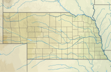
 MLE Location of airport in Nebraska / United States | |||||||||||
| Runways | |||||||||||
| |||||||||||
| Statistics (2005) | |||||||||||
| |||||||||||
Millard Airport (IATA: MIQ, ICAO: KMLE, FAA LID: MLE) is a public airport located seven miles (11 km) southwest of the central business district of Omaha, a city in Douglas County, Nebraska, United States. It is owned and operated by the Omaha Airport Authority,[1] who also owns the main airport of Omaha, Eppley Airfield.
Although most U.S. airports use the same three-letter location identifier for the FAA and IATA, Millard Airport is assigned MLE by the FAA and MIQ by the IATA (which assigned MLE to Malé International Airport on Hulhulé Island in the Malé Atoll of the Maldives).[2][3]
Facilities and aircraft[]
Millard Airport covers an area of 165 acres (67 ha) which contains one asphalt paved runway (12/30) measuring 3,801 x 75 ft (1,159 x 23 m). For the 12-month period ending August 16, 2005, the airport had 72,300 aircraft operations, an average of 198 per day: 98% general aviation, 2% air taxi and <1% military. There are 173 aircraft based at this airport: 82% single-engine, 15% multi-engine, 2% helicopter and 1% jet.[1]
References[]
External links[]
- Millard Airport at Nebraska Department of Aeronautics
- Resources for this airport:
- FAA airport information for MLE
- AirNav airport information for KMLE
- ASN accident history for MIQ
- FlightAware airport information and live flight tracker
- NOAA/NWS weather observations: current, past three days
- SkyVector aeronautical chart, Terminal Procedures
- Airports in Nebraska
- Buildings and structures in Douglas County, Nebraska
- Transportation in Omaha, Nebraska

