Mitane, Akita
Mitane
三種町 | |
|---|---|
Town | |
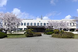 Mitane Town Hall | |
 Flag  Seal | |
 Location of Mitane in Akita Prefecture | |
 Mitane | |
| Coordinates: 40°6′6″N 140°0′18″E / 40.10167°N 140.00500°ECoordinates: 40°6′6″N 140°0′18″E / 40.10167°N 140.00500°E | |
| Country | Japan |
| Region | Tōhoku |
| Prefecture | Akita |
| District | Yamamoto |
| Area | |
| • Total | 248.09 km2 (95.79 sq mi) |
| Population (January 2020) | |
| • Total | 16,172 |
| • Density | 65/km2 (170/sq mi) |
| Time zone | UTC+9 (Japan Standard Time) |
| - Tree | Cryptomeria |
| - Flower | Cherry blossom |
| - Bird | Swan |
| Phone number | 0185-85-2111 |
| Address | 8 Iwayako, Kamogawa-aze, Mitane-chō, Yamamoto-gun, Akita 018-2401 |
| Website | Official website |


Mitane (三種町, Mitane-chō) is a town located in Akita Prefecture, Japan. As of 31 January 2020, the town had an estimated population of 16,172, in 6856 households,[1] and a population density of 65 persons per km². . The total area of the town is 248.09 square kilometres (95.79 sq mi).
Geography[]
Mitane is located in northwestern Akita Prefecture, bordered by the Sea of Japan to the west.
Neighboring municipalities[]
Demographics[]
Per Japanese census data,[2] the population of Mitane peaked at around the year 1950 and has been in steady decline since then.
| Year | Pop. | ±% |
|---|---|---|
| 1920 | 23,761 | — |
| 1930 | 23,743 | −0.1% |
| 1940 | 24,579 | +3.5% |
| 1950 | 32,389 | +31.8% |
| 1960 | 31,733 | −2.0% |
| 1970 | 28,168 | −11.2% |
| 1980 | 26,089 | −7.4% |
| 1990 | 24,151 | −7.4% |
| 2000 | 22,112 | −8.4% |
| 2010 | 18,879 | −14.6% |
Climate[]
Mitane has a Humid continental climate (Köppen climate classification Cfa) with large seasonal temperature differences, with warm to hot (and often humid) summers and cold (sometimes severely cold) winters. Precipitation is significant throughout the year, but is heaviest from August to October. The average annual temperature in Mitane is 11.1 °C. The average annual rainfall is 1527 mm with September as the wettest month. The temperatures are highest on average in August, at around 25.1 °C, and lowest in January, at around -1.0 °C.[3]
History[]
The area of present-day Mitane was part of ancient Dewa Province, dominated by the Satake clan during the Edo period, who ruled Kubota Domain under the Tokugawa shogunate. The area was organized into towns and villages within Yamamoto District, Akita with the establishment of the modern municipalities system in 1889. The town of Mitane was created on March 20, 2006, by merging the towns of Hachiryū, Koto'oka, and Yamamoto.
Economy[]
The economy of Mitane is based on agriculture. The town produces over 90% of the junsai sold commercially in Japan.[4] The center of transportation and economy is the Shikato district in former Kotooka town.
Education[]
Mitane has six public elementary schools and three public middle schools operated by the town government. The town does not have a high school.
Transportation[]
Railway[]
![]() East Japan Railway Company - Ōu Main Line
East Japan Railway Company - Ōu Main Line
- Koikawa - Kado - Moritake - Kita-Kanaoka
Highway[]
Noted people from Mitane[]
- Takashi Miura, professional boxer
References[]
- ^ Mitane Town official statistics (in Japanese)
- ^ Mitane population statistics
- ^ Mitane climate data
- ^ Yotomo Fukudome (June 14, 2016). "恵みの水面、摘み頃 秋田・三種、ジュンサイの収穫が最盛期". Asahi Shimbun. Asahi Shimbun. p. Evening page 10.
External links[]
![]() Media related to Mitane, Akita at Wikimedia Commons
Media related to Mitane, Akita at Wikimedia Commons
- Official Website (in Japanese)
| show Authority control |
|---|
- Mitane, Akita
- Towns in Akita Prefecture
- Populated coastal places in Japan