Montague, Ontario
Montague | |
|---|---|
Township (lower-tier) | |
| Township of Montague | |
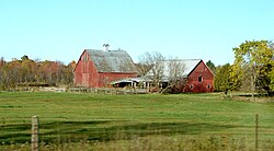 Farm near Numogate | |
 Montague within Lanark County | |
 Montague Montague within southern Ontario | |
| Coordinates: 44°58′N 75°58′W / 44.967°N 75.967°WCoordinates: 44°58′N 75°58′W / 44.967°N 75.967°W | |
| Country | Canada |
| Province | Ontario |
| County | Lanark |
| Government | |
| • Type | Township |
| • Reeve | Bill Dobson |
| • Governing Body | Montague Township Council |
| • MP | Scott Reid (CPC) |
| • MPP | Randy Hillier (OPC) |
| Area | |
| • Total | 279.66 km2 (107.98 sq mi) |
| Population (2016)[1] | |
| • Total | 3,761 |
| • Density | 13.4/km2 (35/sq mi) |
| Time zone | UTC−05:00 (EST) |
| • Summer (DST) | UTC−04:00 (EDT) |
| Area code(s) | 613, 343 |
| Website | www |

Montague is a township in eastern Ontario, Canada, in Lanark County on the Rideau River. The township administrative offices are located on Roger Stevens Drive east of Smiths Falls.
Communities[]
The township comprises the communities of Andrewsville, Atironto, Kilmarnock, Nolans Corners, Numogate, Poolers Corners, Rosedale and Welsh.
Demographics[]
| Canada census – Montague, Ontario community profile | |||
|---|---|---|---|
| 2016 | 2011 | 2006 | |
| Population: | 3,761 (+8.0% from 2011) | 3,483 (+8.5% from 2006) | 3,595 - see notes (-2.1% from 2001) |
| Land area: | 279.66 km2 (107.98 sq mi) | 279.74 km2 (108.01 sq mi) | 277.03 km2 (106.96 sq mi) |
| Population density: | 13.4/km2 (35/sq mi) | 12.5/km2 (32/sq mi) | 13.0/km2 (34/sq mi) |
| Median age: | 43.6 (M: 42.2, F: 41.2) | 43.7 (M: 43.9, F: 43.6) | |
| Total private dwellings: | 1,489 | 1,389 | 1,276 |
| Median household income: | $74,923 | $56,752 | |
| Notes: 2006 population adjusted for 2011 boundaries is 3209. – References: 2016[2] 2011[3] 2006[4] earlier[5] | |||
Language data[]
Mother Tongue (2016 - single responses)
- English: 3,465 (93.40%)
- French: 155 (4.18%)
- Non-Official Languages: 90 (0.24%)
Language Spoken Most Often at Home (2016 - single responses)
- English: 3,635 (97.85%)
- French: 50 (1.34%)
- Non-Official Languages: 30 (0.81%)
Transportation[]
The main roads in the township are the east–west County Road 43, the north–south Ontario Highway 15, and the northeast-southwest Roger Stevens Drive. The Rideau Trail passes through the township between Merrickville and Smiths Falls.
See also[]
References[]
- ^ a b "Census Profile, 2016 Census: Montague, Township". Statistics Canada. Retrieved June 19, 2019.
- ^ "2016 Community Profiles". 2016 Canadian Census. Statistics Canada. February 21, 2017. Retrieved 2017-12-25.
- ^ "2011 Community Profiles". 2011 Canadian Census. Statistics Canada. July 5, 2013. Retrieved 2012-02-15.
- ^ "2006 Community Profiles". 2006 Canadian Census. Statistics Canada. March 30, 2011. Retrieved 2012-02-15.
- ^ "2001 Community Profiles". 2001 Canadian Census. Statistics Canada. February 17, 2012.
External links[]
 Media related to Montague, Ontario at Wikimedia Commons
- Township of Montague
Places adjacent to Montague, Ontario | ||||||||||||||||
|---|---|---|---|---|---|---|---|---|---|---|---|---|---|---|---|---|
| ||||||||||||||||
This Eastern Ontario geographical article is a stub. You can help Wikipedia by . |
Categories:
- Township municipalities in Ontario
- Lower-tier municipalities in Ontario
- Municipalities in Lanark County
- Eastern Ontario geography stubs