Montecito Heights, Los Angeles
This article needs additional citations for verification. (November 2017) |
Montecito Heights | |
|---|---|
Neighborhood of Los Angeles | |
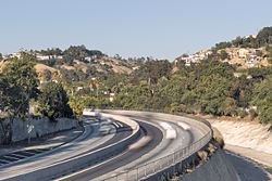 Viewed from Pasadena Ave. bridge | |
 Montecito Heights Location within Central Los Angeles | |
| Coordinates: 34°05′25″N 118°12′10″W / 34.090258°N 118.202889°W | |
| Country | United States |
| State | California |
| County | Los Angeles |
| City | Los Angeles |
| Time zone | UTC-8 (PST) |
| • Summer (DST) | UTC-7 (PDT) |
| ZIP code | 90031 |

Montecito Heights is a neighborhood in the Northeast Los Angeles region of Los Angeles, California. The population in 2000 was estimated at 16,768.[1]
Geography and transportation[]
Montecito Heights' boundaries are roughly the Pasadena Freeway (SR 110) or the Arroyo Seco on the northwest, Pasadena Avenue on the west, Avenue 33 to the south, Huntington Drive to the southeast, and Monterey Road to the east. Neighboring districts include Monterey Hills on the northeast, El Sereno on the southeast, Lincoln Heights on the southwest, Mount Washington on the northwest, and Highland Park on the north. Owing to the rugged terrain, no major thoroughfares run through the area, besides . The district is largely in ZIP code 90031.
Neighborhood[]
Known by the residents as the 'Wilderness in the City',[citation needed] Montecito Heights sits on the Monterey Hills that divide the Los Angeles Basin from the San Gabriel Valley. Montecito Heights is a relatively isolated area of greenery and trendy resident home restorers.[original research?] City views are available on the district's hills.[citation needed] Along with neighboring Highland Park and Pasadena, it is one of the historic centers of the Arts and Crafts movement.[citation needed]
Landmarks[]
Notable residents[]
- Alana Cordy-Collins, anthropologist and archaeologist
- Napoleon Cordy, Mayanist
- John Strother Griffin, the founder of East Los Angeles
- Bricia Lopez, author and restaurateur[2]
- Jackson Pollock, artist
References[]
- ^ Los Angeles Times. "Montecito Heights Profile". Mapping L.A. Retrieved 2010-06-26.
- ^ "MEET BRICIA". Super Mamas. Retrieved 2 January 2020.
External links[]
- Arroyo Seco Neighborhood Council
- Montecito Heights Improvement Association
- Montecito Heights profile by the Los Angeles Times
| show |
|---|


Coordinates: 34°05′25″N 118°12′10″W / 34.090258°N 118.202889°W
- Montecito Heights, Los Angeles
- Neighborhoods in Los Angeles
- Northeast Los Angeles
- San Rafael Hills