Montgey
Montgey | |
|---|---|
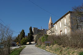 The road into Montgey | |
 Coat of arms | |
show Location of Montgey | |
 Montgey | |
| Coordinates: 43°30′34″N 1°56′32″E / 43.5094°N 1.9422°ECoordinates: 43°30′34″N 1°56′32″E / 43.5094°N 1.9422°E | |
| Country | France |
| Region | Occitanie |
| Department | Tarn |
| Arrondissement | Castres |
| Canton | Lavaur Cocagne |
| Intercommunality | Lauragais-Revel-Sorezois |
| Government | |
| • Mayor (2020–2026) | Pierre Fraissé[1] |
| Area 1 | 9.91 km2 (3.83 sq mi) |
| Population (Jan. 2018)[2] | 282 |
| • Density | 28/km2 (74/sq mi) |
| Time zone | UTC+01:00 (CET) |
| • Summer (DST) | UTC+02:00 (CEST) |
| INSEE/Postal code | 81179 /81470 |
| Elevation | 182–332 m (597–1,089 ft) (avg. 217 m or 712 ft) |
| 1 French Land Register data, which excludes lakes, ponds, glaciers > 1 km2 (0.386 sq mi or 247 acres) and river estuaries. | |


Montgey is a commune in the Tarn department in southern France.
See also[]
- Communes of the Tarn department
References[]
- ^ "Répertoire national des élus: les maires". data.gouv.fr, Plateforme ouverte des données publiques françaises (in French). 2 December 2020.
- ^ "Populations légales 2018". INSEE. 28 December 2020.
| Wikimedia Commons has media related to Montgey. |
| show Authority control |
|---|
This Tarn geographical article is a stub. You can help Wikipedia by . |
Categories:
- Communes of Tarn (department)
- Tarn (department) geography stubs