Montherlant, Oise
Montherlant | |
|---|---|
Part of Saint-Crépin-Ibouvillers | |
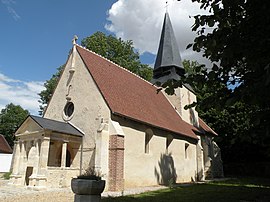 Church of the Assumption | |
show Location of Montherlant | |
 Montherlant | |
| Coordinates: 49°16′44″N 2°03′01″E / 49.2789°N 2.0503°ECoordinates: 49°16′44″N 2°03′01″E / 49.2789°N 2.0503°E | |
| Country | France |
| Region | Hauts-de-France |
| Department | Oise |
| Arrondissement | Beauvais |
| Canton | Méru |
| Commune | Saint-Crépin-Ibouvillers |
| Area 1 | 5.18 km2 (2.00 sq mi) |
| Population (2017)[1] | 160 |
| • Density | 31/km2 (80/sq mi) |
| Time zone | UTC+01:00 (CET) |
| • Summer (DST) | UTC+02:00 (CEST) |
| Postal code | 60790 |
| Elevation | 119–190 m (390–623 ft) (avg. 146 m or 479 ft) |
| 1 French Land Register data, which excludes lakes, ponds, glaciers > 1 km2 (0.386 sq mi or 247 acres) and river estuaries. | |


Montherlant is a former commune in the Oise department in northern France. It joined the commune of Saint-Crépin-Ibouvillers in January 2015.[2]
See also[]
References[]
- ^ Téléchargement du fichier d'ensemble des populations légales en 2017, INSEE
- ^ Arrêté préfectoral 30 September 2014 (in French)
| Wikimedia Commons has media related to Montherlant (Oise). |
This Oise geographical article is a stub. You can help Wikipedia by . |
Categories:
- Former communes of Oise
- Populated places disestablished in 2015
- Oise geography stubs