Moosberg
| Moosberg | |
|---|---|
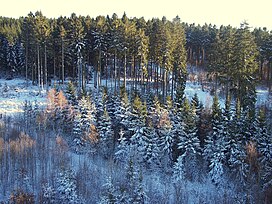 The wooded summit of the Moosberg | |
| Highest point | |
| Elevation | 513 m above sea level (NN) (1,683.1 ft) |
| Coordinates | 51°45′13″N 9°33′09″E / 51.75361°N 9.5525°ECoordinates: 51°45′13″N 9°33′09″E / 51.75361°N 9.5525°E |
| Geography | |
 Moosberg | |
| Parent range | Solling, Weser Uplands |

The Moosberg is a 513.0 m high hill in the Solling range, which is located in southwestern Lower Saxony (Germany).
Geography[]
The hill lies in the "Hochsolling", the central and highest part of the Solling, which is surrounded by the Solling-Vogler Nature Park. This heavily wooded hill is a little south of the half way point between Boffzen and Dassel, as the crow flies, and around 1.5 km east of .
From topographical maps it is clear, for example from trigonometric points that there are three different summit on the Moosberg at 513.0 m (north), 508.7 m (centre) and 508.6 m (south).
On the western slope of the Moosberg is the Hochsolling Observation Tower.
Sights[]
- Hochsolling Observation Tower
- Mecklenbruch (raised bog and nature reserve)
- Neuhaus Deer Park (and forest museum)
| Authority control |
|
|---|
Categories:
- Hills of Lower Saxony
- Solling