Morafenobe District
Morafenobe District | |
|---|---|
District | |
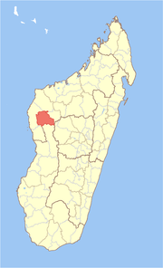 Location in Madagascar | |
| Coordinates: 16°9′S 46°37′E / 16.150°S 46.617°E | |
| Country | |
| Region | Melaky |
| Area | |
| • Total | 6,976 km2 (2,693 sq mi) |
| Population (2001) | |
| • Total | 20,475 |
| • Density | 2.9/km2 (8/sq mi) |
| • Ethnicities | Sakalava |
| Time zone | UTC3 (EAT) |

Morafenobe is a district in western Madagascar. It is a part of Melaky Region and borders the districts of Besalampy in north, Ambatomainty in east, Miandrivazo in south, Antsalova in southwest and Maintirano in west. The area is 6,976 km2 (2,693 sq mi) and the population was estimated to be 20,475 in 2001.[1]
Communes[]
The district is further divided into four communes:
References and notes[]
- ^ Jump up to: a b "Madagascar Administrative units". GeoHive. Retrieved 2008-03-04.
Coordinates: 16°9′S 46°37′E / 16.150°S 46.617°E
| hide | ||
|---|---|---|
Capital: Maintirano | ||
| Antsalova (5) | 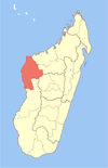 | |
| Ambatomainty (5) | ||
| Besalampy (6) | ||
| Maintirano (14) | ||
| Morafenobe (4) | ||
5 districts; 34 communes | ||
| Authority control |
|
|---|
This Melaky location article is a stub. You can help Wikipedia by . |
Categories:
- Madagascar geography stubs
- Districts of Melaky