Morley, Ontario
Morley | |
|---|---|
Township (single-tier) | |
| Township of Morley | |
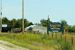 Stratton | |
 Morley | |
| Coordinates: 48°50′N 94°10′W / 48.833°N 94.167°WCoordinates: 48°50′N 94°10′W / 48.833°N 94.167°W | |
| Country | Canada |
| Province | Ontario |
| District | Rainy River |
| Settled | 1880s |
| Incorporated | 1903 |
| Government | |
| • Reeve | George Heyens |
| • Federal riding | Thunder Bay—Rainy River |
| • Prov. riding | Kenora—Rainy River |
| Area | |
| • Land | 390.61 km2 (150.82 sq mi) |
| Population (2016)[2] | |
| • Total | 481 |
| • Density | 1.2/km2 (3/sq mi) |
| Time zone | UTC-6 (CST) |
| • Summer (DST) | UTC-5 (CDT) |
| Postal Code FSA | P0W 1N0 |
| Area code(s) | 807 |
| Website | www.townshipofmorley.ca |

Morley is a township in the Canadian province of Ontario, located within the Rainy River District. The township had a population of 481 in the Canada 2016 Census. Named after John Morley, it was formed in 1903 when the townships of Morley and Pattullo, as well as the village of Stratton, were amalgamated.[3]
In 2004, the Township of Morley was greatly expanded through the addition of the geographic townships of Sifton and Dewart, that were previously part of Unorganized Rainy River District.[3]
Demographics[]
Canada census – Morley community profile
| 2016 | 2011 | |
|---|---|---|
| Population | 481 (-4.0% from 2011) | 501 (+1.8% from 2006) |
| Land area | 390.61 km2 (150.82 sq mi) | 375.61 km2 (145.02 sq mi) |
| Population density | 1.2/km2 (3.1/sq mi) | 1.3/km2 (3.4/sq mi) |
| Median age | 40.6 (M: 41.1, F: 40.3) | 45.5 (M: 45.9, F: 44.2) |
| Total private dwellings | 232 | 227 |
| Median household income | $71,680 |
| Year | Pop. | ±% |
|---|---|---|
| 1991 | 435 | — |
| 1996 | 478 | +9.9% |
| 2001 | 447 | −6.5% |
| 2006 | 492 | +10.1% |
| 2011 | 501 | +1.8% |
| 2016 | 481 | −4.0% |
| [7][8][2] 2001 population would have been 526 if 2006 boundaries were used | ||
See also[]
References[]
- ^ a b "2011 Community Profiles". 2011 Canadian Census. Statistics Canada. March 21, 2019. Retrieved 2012-03-30.
- ^ a b "Census Profile, 2016 Census: Morley, Township". Statistics Canada. Retrieved July 1, 2019.
- ^ a b "The Full History". The Corporation of the Township of Morley. Archived from the original on 2012-03-23. Retrieved 2011-05-04.
- ^ "2016 Community Profiles". 2016 Canadian Census. Statistics Canada. August 12, 2021. Retrieved 2019-07-01.
- ^ "2006 Community Profiles". 2006 Canadian Census. Statistics Canada. August 20, 2019.
- ^ "2001 Community Profiles". 2001 Canadian Census. Statistics Canada. July 18, 2021.
- ^ Statistics Canada: 2001, 2006, 2011 census
- ^ "Morley census profile". 2011 Census of Population. Statistics Canada. Retrieved 2012-03-30.
External links[]
Places adjacent to Morley, Ontario | |
|---|---|
| Towns |  | |
|---|---|---|
| Townships | ||
| First Nations | ||
| Indian reserves |
| |
| Unorganized areas | ||
| Unincorporated communities | ||
| ||
This Northern Ontario geographical article is a stub. You can help Wikipedia by . |
Categories:
- Municipalities in Rainy River District
- Single-tier municipalities in Ontario
- Township municipalities in Ontario
- Northern Ontario geography stubs