Morrison Hill

| Morrison Hill | |||||||||||
|---|---|---|---|---|---|---|---|---|---|---|---|
| Chinese | 摩理臣山 | ||||||||||
| |||||||||||
| Alternative Chinese name | |||||||||||
| Chinese | 摩利臣山 | ||||||||||
| |||||||||||


Morrison Hill (Chinese: 摩理臣山 or 摩利臣山) is an area and the location of a former hill between Wan Chai and Happy Valley, on Hong Kong Island in Hong Kong.
History[]
The hill was at the seashore until the Praya East Reclamation Scheme in the 1920s, which used its constituent rock/earth to reclaim land from the harbour, extending the shoreline away from the area. This major operation took most of the decade and to carry away the rock and soil, temporary railway tracks were laid, running along Bowrington Canal (present day Canal Road), which was covered over for the purpose.[1]
The hill was named for Protestant missionary and linguist Dr Robert Morrison who travelled through the region as part of the Morrison Education Society.[2][3]
Features[]
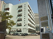
Today, the centre of the area is occupied by the Morrison Hill Swimming Pool and several secondary schools, within a circular street, Oi Kwan Road (愛群道). A main road, Morrison Hill Road (摩理臣山道), runs along the east side of the area. The Queen Elizabeth Stadium and the Tang Shiu Kin Hospital are on its southern fringe. There is also a skatepark near the children's playground to the south-east.
Facilities along Oi Kwan Road[]
Amenity facilities include:
Medical establishments include:
Educational institutions include:
- (with the headquarters of by its side),
- Tang Shiu Kin Victoria Government Secondary School
- Sheng Kung Hui Tang Shiu Kin Secondary School
Other major facilities include:
References[]
- ^ 1920s Excavation of Morrison Hill, Gwulo
- ^ Garrett, Valery (2011). Elizabeth Sinn (ed.). Dictionary of Hong Kong Biography. Hong Kong University Press. p. 329.
- ^ Carey, W. H. (1850). Oriental Christian Biography, Containing Biographical Sketches of Distinguished Christians Who Have Lived and Died in the East. Calcutta, Baptist Mission Press. p. 193.
| Wikimedia Commons has media related to Morrison Hill. |
This Hong Kong Island location article is a stub. You can help Wikipedia by . |
Coordinates: 22°16′31″N 114°10′47″E / 22.27538°N 114.17969°E

- Morrison Hill
- Hong Kong Island geography stubs