Moulin-Mage
Moulin-Mage | |
|---|---|
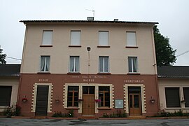 The mairie in Moulin-Mage | |
show Location of Moulin-Mage | |
 Moulin-Mage | |
| Coordinates: 43°42′46″N 2°48′21″E / 43.7128°N 2.8058°ECoordinates: 43°42′46″N 2°48′21″E / 43.7128°N 2.8058°E | |
| Country | France |
| Region | Occitanie |
| Department | Tarn |
| Arrondissement | Castres |
| Canton | Les Hautes Terres d'Oc |
| Intercommunality | Monts de Lacaune et Montagne du Haut Languedoc |
| Government | |
| • Mayor (2020–2026) | Isabelle Calvet |
| Area 1 | 15.06 km2 (5.81 sq mi) |
| Population (Jan. 2018)[1] | 318 |
| • Density | 21/km2 (55/sq mi) |
| Time zone | UTC+01:00 (CET) |
| • Summer (DST) | UTC+02:00 (CEST) |
| INSEE/Postal code | 81188 /81320 |
| Elevation | 834–1,022 m (2,736–3,353 ft) (avg. 880 m or 2,890 ft) |
| 1 French Land Register data, which excludes lakes, ponds, glaciers > 1 km2 (0.386 sq mi or 247 acres) and river estuaries. | |


Moulin-Mage is a commune in the Tarn department and Occitanie region of southern France.
The name of the settlement – Molin Màger in Occitan – means "main mill".
See also[]
- Communes of the Tarn department
References[]
- ^ "Populations légales 2018". INSEE. 28 December 2020.
| Wikimedia Commons has media related to Moulin-Mage. |
| show Authority control |
|---|
This Tarn geographical article is a stub. You can help Wikipedia by . |
Categories:
- Communes of Tarn (department)
- Tarn (department) geography stubs