Mount Aka (Yatsugatake)
| Mount Aka | |
|---|---|
| 赤岳 | |
 Mount Aka | |
| Highest point | |
| Elevation | 2,899 m (9,511 ft)[1] |
| Prominence | 1,916 m (6,286 ft)[1] |
| Listing | List of mountains and hills of Japan by height Ultra |
| Coordinates | 35°58′14″N 138°22′12″E / 35.97056°N 138.37000°ECoordinates: 35°58′14″N 138°22′12″E / 35.97056°N 138.37000°E[1] |
| Naming | |
| English translation | Red Mountain |
| Language of name | Japanese |
| Pronunciation | Japanese: [akadake] |
| Geography | |
 Mount Aka Japan | |
| Location | On the border of Chino, Hara of Nagano, and Hokuto of Yamanashi in Japan |
| Parent range | Southern Yatsugatake Volcanic Group |
| Geology | |
| Mountain type | Stratovolcano |
| Volcanic arc/belt | Northeastern Japan Arc |

Mount Aka (赤岳, Aka-dake) is a 2,899m mountain on the border of Chino, Hara of Nagano, and Hokuto of Yamanashi in Japan. This mountain is the tallest mountain of Yatsugatake Mountains.
Description[]
Mount Aka is a stratovolcano. This mountain is a center of the Yatsugatake-Chūshin Kōgen Quasi-National Park.
Climbing route[]
There are several routes to reach to the top of Mount Aka. The most popular route is from Minoto. It takes about four and half hours.
Access[]
- of Suwa Bus
Gallery[]
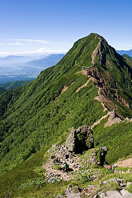
Mount Aka from north side
from Mount Aka

Mount Asama from Mount Aka

Mount Iō and Mount Yoko from Mount Aka

Akaishi Mountains from Mount Aka

Mount Tateshina and Hida Mountains from Mount Aka
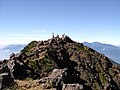
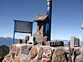
The top of Mount Aka
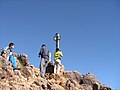
at the top of Mount Aka

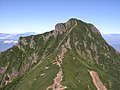
Mount Aka (December 2006)


See also[]
References[]
- ^ Jump up to: a b c "Japan Ultra-Prominences". Peaklist.org. Retrieved 2015-01-01.
External links[]
- Ministry of Environment of Japan
- Official Home Page of the Geographical Survey Institute in Japan
- ‘Yatsugatake, Tateshina, Utsukushigahara, Kirigamine 2008, Shobunsha
This geology article is a stub. You can help Wikipedia by . |
- Mountains of Nagano Prefecture
- Mountains of Yamanashi Prefecture
- Volcanoes of Nagano Prefecture
- Volcanoes of Yamanashi Prefecture
- Geology stubs