Mount Balfour (Antarctica)
Mount Balfour (69°19′00″S 67°13′00″W / 69.31667°S 67.21667°WCoordinates: 69°19′00″S 67°13′00″W / 69.31667°S 67.21667°W) is a bastion-like rocky mountain, 1,010 metres (3,310 ft) high, which lies at the mouth of Fleming Glacier, close to the junction with the Wordie Ice Shelf on the west side of the Antarctic Peninsula. First roughly surveyed in 1936 by the British Graham Land Expedition under Rymill, and resurveyed by the Falklands Islands Dependencies Survey in 1948. It was named for Henry Balfour, President of the Royal Geographical Society from 1936 to 1938.
 WikiMiniAtlas
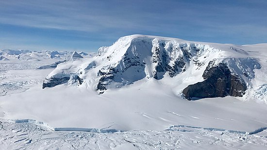
References[]
![]() This article incorporates public domain material from the United States Geological Survey document: "Mount Balfour". (content from the Geographic Names Information System)
This article incorporates public domain material from the United States Geological Survey document: "Mount Balfour". (content from the Geographic Names Information System)
This Palmer Land location article is a stub. You can help Wikipedia by . |
- Mountains of Palmer Land
- Palmer Land geography stubs