Mount Hereford
| Mount Hereford | |
|---|---|
| Mont Hereford | |
| Highest point | |
| Elevation | 864 m (2,835 ft)[1][2] |
| Prominence | 379 m (1,243 ft)[3] |
| Isolation | 19.66 km (12.22 mi)[3] |
| Coordinates | 45°04′56″N 71°36′05″W / 45.08222°N 71.60139°WCoordinates: 45°04′56″N 71°36′05″W / 45.08222°N 71.60139°W[4] |
| Naming | |
| Language of name | fr |
| Geography | |
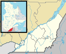
| Location | Quebec, Canada |
| Parent range | Appalachian Mountains |
| Topo map | NTS 21E4 Coaticook |
| Climbing | |
| Easiest route | hiking |

Mount Hereford (French: Mont Hereford) is a mountain located in Coaticook Regional County Municipality, Estrie, Quebec, Canada. It rises to 864 metres (2,835 ft).[1][2]
Etymology[]
Mount Hereford is a reference to a city and a county of the same name in England.[5] A dictionary from 1832 refers to it as "Hereford Mountain." However, some locals refer to it as Montagne à Goyette or Montagne chez Goyette (translation: Goyette's Mountain).[6]
History[]
This section needs expansion. You can help by . (July 2015) |
Recreation[]
It is possible to hike to the summit of Mount Hereford via the Neil Tillotson Hiking Trail, which is a 12 kilometres (7.5 mi) long linear trail. It is accessible from either Clowery Road in Saint-Herménégilde or Coaticook Road in East Hereford. Other activities permitted include snowshoeing, cross-country skiing, and wildlife observation.
References[]
- ^ Jump up to: a b Farfan, Matthew. "Mount Hereford by Foot or by Car". Townships Heritage. Retrieved 20 August 2014.
- ^ Jump up to: a b "Mont Hereford" (in French). Municipalité de St-Herménégilde. Retrieved 20 August 2014.
- ^ Jump up to: a b "Mont Hereford". Peakbagger.com. Retrieved 20 August 2014.
- ^ Reference number 138369 of the Commission de toponymie du Québec (in French)
- ^ Reference number 177280 of the Commission de toponymie du Québec (in French)
- ^ Reference number 28562 of the Commission de toponymie du Québec (in French)
External links[]
- Mountains of Quebec under 1000 metres
- Tourist attractions in Estrie