Mount Karakuni
| Mount Karakuni | |
|---|---|
| Karakunidake | |
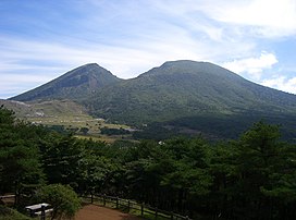 Mount Karakuni, September 2008 | |
| Highest point | |
| Elevation | 1,700 m (5,600 ft)[1] |
| Coordinates | 31°56′03″N 130°51′42″E / 31.93417°N 130.86167°ECoordinates: 31°56′03″N 130°51′42″E / 31.93417°N 130.86167°E |
| Geography | |
 Mount Karakuni | |

Karakunidake (韓国岳) or Mount Karakuni (1,700m) is a mountain in Kagoshima and Miyazaki Prefectures, Japan. It is part of Kirishima-Yaku National Park.[1][2]
Name[]
Karakunidake was named as such from two accounts before the Edo period: the first of which referred to the mountain's barren surface, and the second which claimed that climbers can see the distant Korean Peninsula across the sea.[3]
Some maps erroneously spell its name as "唐国岳" (Karakunidake), with the kanji "唐" in place of "韓".
See also[]
| Wikimedia Commons has media related to Mount Karakuni. |
- Kirishima-Yaku National Park
References[]
- ^ Jump up to: a b "Kirishima-Yaku National Park". Natural Parks Foundation. Archived from the original on 11 June 2011. Retrieved 24 March 2011.
- ^ "Introducing places of interest: Kirishima-Yaku National Park". Ministry of the Environment. Archived from the original on 22 March 2011. Retrieved 24 March 2011.
- ^ Mt. Karakunidake - Japan National Tourism Organization
This Kagoshima Prefecture location article is a stub. You can help Wikipedia by . |
This Miyazaki Prefecture location article is a stub. You can help Wikipedia by . |
Categories:
- Mountains of Kagoshima Prefecture
- Mountains of Miyazaki Prefecture
- Kirishima-Yaku National Park
- Highest points of Japanese national parks
- Kagoshima geography stubs
- Miyazaki geography stubs