Mount Leyli
This article does not cite any sources. (September 2013) |
| Mount Leyli | |
|---|---|
 Mount Leyli | |
| Highest point | |
| Elevation | 3,157 m (10,358 ft) |
| Coordinates | 41°09′56″N 43°57′15″E / 41.16556°N 43.95417°ECoordinates: 41°09′56″N 43°57′15″E / 41.16556°N 43.95417°E |
| Geography | |
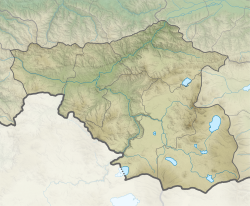 Mount Leyli Location of Mount Leyli between Kvemo Kartli and Samtskhe-Javakheti regions | |
| Parent range | Javakheti |
| Geology | |
| Age of rock | Quaternary |

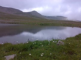
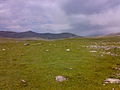
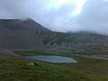
Mount Leyli, also Leili (Georgian: ლეილი) is a 3,157 m (10,358 ft) tall mountain between the Georgian provinces of Samtskhe-Javakheti and Kvemo Kartli. Leyli is second highest peak of the Javakheti Range in the Lesser Caucasus Mountains.
See also[]
| Wikimedia Commons has media related to Leyli. |
- List of volcanoes in Georgia (country)
- Javakheti Range
- Mount Aghchala
- Mount Yemlikli
Image gallery[]
This Georgia location article is a stub. You can help Wikipedia by . |
Categories:
- Mountains of Georgia (country)
- Volcanoes of Georgia (country)
- Geography of Kvemo Kartli
- Geography of Samtskhe–Javakheti
- Mountains of Samtskhe-Javakheti region
- Quaternary volcanoes
- Georgia (country) geography stubs