Mount Manchester
| Mount Manchester | |
|---|---|
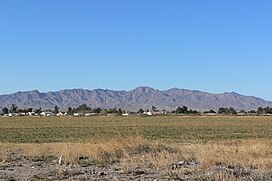 View looking west (Dead Mountains trend S-N) | |
| Highest point | |
| Elevation | 3,602 ft (1,098 m) NAVD 88[1] |
| Coordinates | 35°01′40″N 114°44′56″W / 35.027808986°N 114.748938169°WCoordinates: 35°01′40″N 114°44′56″W / 35.027808986°N 114.748938169°W[1] |
| Geography | |
| Location | San Bernardino County, California, U.S. |
| Parent range | Dead Mountains |
| Climbing | |
| Easiest route | Hike |

Mount Manchester is the highest peak in the Dead Mountains of extreme northeastern San Bernardino County, California, in the Mojave Desert.
Dead Mountains Wilderness[]
Mount Manchester the high point of the Bureau of Land Management wilderness area which comprises most of the Dead Mountains.[2]
The Dead Mountains border the Colorado River on the east, and the Piute Wash of the Piute Valley on the west. Piute wash drains south, then turns east for 8 miles (13 km) at the south of the range to meet the Colorado River.
 Mount Manchester, view from SE of Dead Mountains, at base of wash and alluvial fan-(4 mi NW of Needles) |
 Closer view from SE (on River Road, (west bank of Colorado River)) (Pinnacle NE of Mount Manchester is identifier) |
See also[]
- Category: Protected areas of the Mojave Desert
References[]
- ^ a b "Dead". NGS data sheet. U.S. National Geodetic Survey. Retrieved 2011-07-13.
- ^ Dead Mountains Wilderness Archived 2009-03-05 at the Wayback Machine
External links[]
This San Bernardino County, California–related article is a stub. You can help Wikipedia by . |
Categories:
- Mountains of San Bernardino County, California
- Protected areas of the Mojave Desert
- Bureau of Land Management areas in California
- Mountains of Southern California
- San Bernardino County, California geography stubs