Mount Pearigen
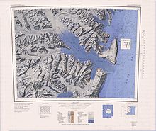
Topographic reconnaissance map of the Cape Hallet area from in Antarctica, including the Mount Pearigen
Mount Pearigen (72°1′S 168°50′E / 72.017°S 168.833°ECoordinates: 72°1′S 168°50′E / 72.017°S 168.833°E) is a prominent mountain (3,020 m) standing 6 nautical miles (11 km) northwest of Mount Hart in the Admiralty Mountains. Mapped by United States Geological Survey (USGS) from surveys and U.S. Navy air photos, 1960–64. Named by Advisory Committee on Antarctic Names (US-ACAN) for Lieutenant Commander , U.S. Navy, helicopter pilot in Operation Deep Freeze 1968, 1969 and 1970.
 WikiMiniAtlas
![]() This article incorporates public domain material from the United States Geological Survey document: "Mount Pearigen". (content from the Geographic Names Information System)
This article incorporates public domain material from the United States Geological Survey document: "Mount Pearigen". (content from the Geographic Names Information System) ![]()
This Borchgrevink Coast location article is a stub. You can help Wikipedia by . |
Categories:
- Mountains of Victoria Land
- Borchgrevink Coast
- Borchgrevink Coast geography stubs