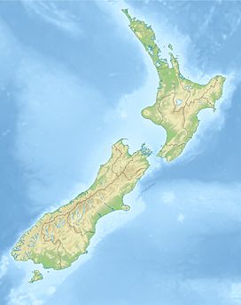
Mount Richardson (Southland)
| Mount Richardson | |
|---|---|
 Mount Richardson Location in New Zealand | |
| Highest point | |
| Elevation | 540 m (1,770 ft) |
| Coordinates | 44°29′06″S 167°55′05″E / 44.485°S 167.918°ECoordinates: 44°29′06″S 167°55′05″E / 44.485°S 167.918°E |
| Geography | |
| Location | South Island, New Zealand |
Mount Richardson is in northern Fiordland, in the Southland District of New Zealand,[1] in the southwestern part of the country. The summit is 485 metres (1,591 ft) above sea level.[2] The terrain around Mount Richardson is hilly to the northwest, and mountainous to the southeast.
The highest point in the area is , 1,703 meters above sea level, 7.9 km south of Mount Richardson.[3] Less than two people per square kilometer live around Mount Richardson.[4] There is no town in the area. Mount Richardson is almost completely covered in forest.[5] The hill is named after John Richardson, who was the third Superintendent of Otago Province.[2]
The average rainfall 2,920 millimeters per year. The wettest month is October, with 356 millimeters of rain, and the wettest February, with 152 millimeters.[6]
Viewfinder Panoramas, within a 10 kilometer radius.[7] The full algorithm is available here.
References[]
- ^ 20richardson.html Mount Richardson at Geonames.org (cc-by); post updated 2006-03-04; database download on 2016-11-12
- ^ a b "Place name detail: Mount Richardson". New Zealand Gazetteer. New Zealand Geographic Board. Retrieved 26 January 2021.
- ^ "Place name detail: Te Hau". New Zealand Gazetteer. New Zealand Geographic Board. Retrieved 26 January 2021.
- ^ "NASA Earth Observations: Population Density". NASA / SEDAC. Retrieved 30 January 2016.
- ^ "NASA Earth Observations: Land Cover Classification". NASA / MODIS. Retrieved 30 January 2016.
- ^ "NASA Earth Observations: Rainfall (1 month - TRMM)". NASA / Tropical Rainfall Monitoring Mission. Retrieved 30 January 2016.
- ^ "Viewfinder Panoramas Digital elevation Model". 21 June 2015.
- Mountains of Fiordland
- Southland District
